

116
K. Shrestha et al.
7.10 Results and Discussion
7.10.1 Landslide Mapping
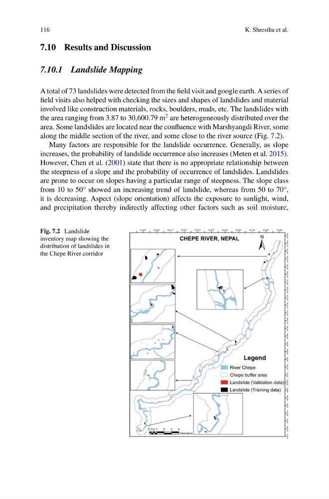
A total of 73 landslides were detected from the field visit and google earth. A series of
field visits also helped with checking the sizes and shapes of landslides and material
involved like construction materials, rocks, boulders, muds, etc. The landslides with
the area ranging from 3.87 to 30,600.79 m
2 are heterogeneously distributed over the
area. Some landslides are located near the confluence with Marshyangdi River, some
along the middle section of the river, and some close to the river source (Fig. 7.2).
Many factors are responsible for the landslide occurrence. Generally, as slope
increases, the probability of landslide occurrence also increases (Meten et al. 2015).
However, Chen et al. (2001) state that there is no appropriate relationship between
the steepness of a slope and the probability of occurrence of landslides. Landslides
are prone to occur on slopes having a particular range of steepness. The slope class
from 10 to 50° showed an increasing trend of landslide, whereas from 50 to 70°,
it is decreasing. Aspect (slope orientation) affects the exposure to sunlight, wind,
and precipitation thereby indirectly affecting other factors such as soil moisture,
Fig. 7.2 Landslide
inventory map showing the
distribution of landslides in
the Chepe River corridor
K. Shrestha et al.
7.10 Results and Discussion
7.10.1 Landslide Mapping
A total of 73 landslides were detected from the field visit and google earth. A series of
field visits also helped with checking the sizes and shapes of landslides and material
involved like construction materials, rocks, boulders, muds, etc. The landslides with
the area ranging from 3.87 to 30,600.79 m
2 are heterogeneously distributed over the
area. Some landslides are located near the confluence with Marshyangdi River, some
along the middle section of the river, and some close to the river source (Fig. 7.2).
Many factors are responsible for the landslide occurrence. Generally, as slope
increases, the probability of landslide occurrence also increases (Meten et al. 2015).
However, Chen et al. (2001) state that there is no appropriate relationship between
the steepness of a slope and the probability of occurrence of landslides. Landslides
are prone to occur on slopes having a particular range of steepness. The slope class
from 10 to 50° showed an increasing trend of landslide, whereas from 50 to 70°,
it is decreasing. Aspect (slope orientation) affects the exposure to sunlight, wind,
and precipitation thereby indirectly affecting other factors such as soil moisture,
Fig. 7.2 Landslide
inventory map showing the
distribution of landslides in
the Chepe River corridor