

351
− A method based on calculating the spatial position of the fault based on existing contours
that reach it from both sides. In the case of a small number of isolines, tools are used to
compact contours.
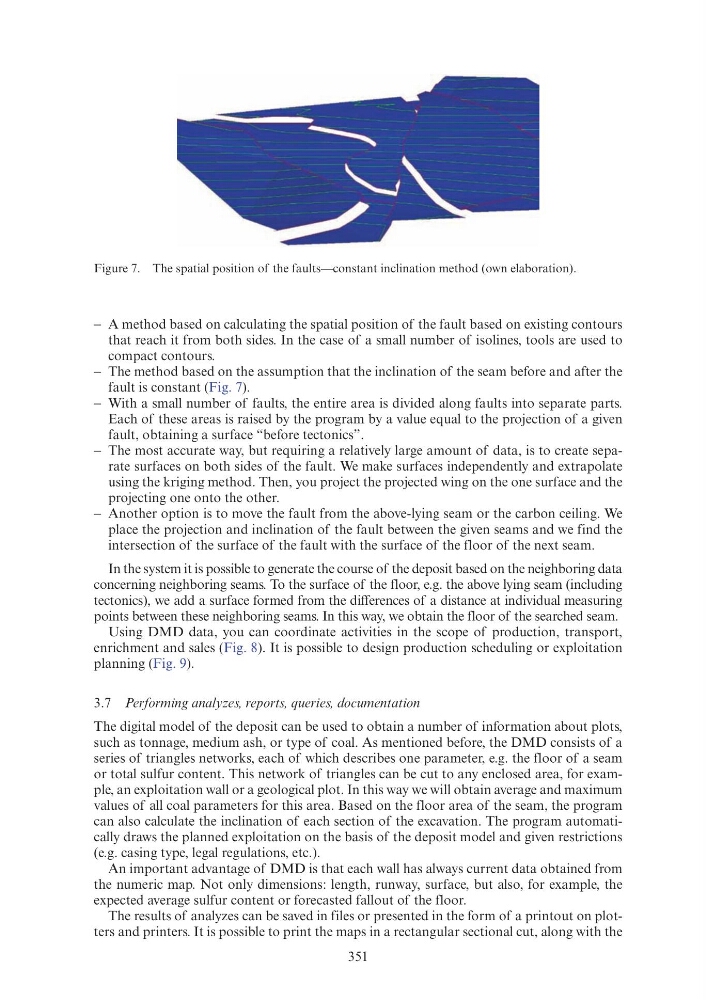
− The method based on the assumption that the inclination of the seam before and after the
fault is constant (Fig. 7).
− With a small number of faults, the entire area is divided along faults into separate parts.
Each of these areas is raised by the program by a value equal to the projection of a given
fault, obtaining a surface “before tectonics”.
− The most accurate way, but requiring a relatively large amount of data, is to create separate surfaces on both sides of the fault. We make surfaces independently and extrapolate
using the kriging method. Then, you project the projected wing on the one surface and the
projecting one onto the other.
− Another option is to move the fault from the above-lying seam or the carbon ceiling. We
place the projection and inclination of the fault between the given seams and we find the
intersection of the surface of the fault with the surface of the floor of the next seam.
In the system it is possible to generate the course of the deposit based on the neighboring data
concerning neighboring seams. To the surface of the floor, e.g. the above lying seam (including
tectonics), we add a surface formed from the differences of a distance at individual measuring
points between these neighboring seams. In this way, we obtain the floor of the searched seam.
Using DMD data, you can coordinate activities in the scope of production, transport,
enrichment and sales (Fig. 8). It is possible to design production scheduling or exploitation
planning (Fig. 9).
3.7 Performing analyzes, reports, queries, documentation
The digital model of the deposit can be used to obtain a number of information about plots,
such as tonnage, medium ash, or type of coal. As mentioned before, the DMD consists of a
series of triangles networks, each of which describes one parameter, e.g. the floor of a seam
or total sulfur content. This network of triangles can be cut to any enclosed area, for example, an exploitation wall or a geological plot. In this way we will obtain average and maximum
values of all coal parameters for this area. Based on the floor area of the seam, the program
can also calculate the inclination of each section of the excavation. The program automatically draws the planned exploitation on the basis of the deposit model and given restrictions
(e.g. casing type, legal regulations, etc.).
An important advantage of DMD is that each wall has always current data obtained from
the numeric map. Not only dimensions: length, runway, surface, but also, for example, the
expected average sulfur content or forecasted fallout of the floor.
The results of analyzes can be saved in files or presented in the form of a printout on plotters and printers. It is possible to print the maps in a rectangular sectional cut, along with the
Figure 7. The spatial position of the faults—constant inclination method (own elaboration).
− A method based on calculating the spatial position of the fault based on existing contours
that reach it from both sides. In the case of a small number of isolines, tools are used to
compact contours.
− The method based on the assumption that the inclination of the seam before and after the
fault is constant (Fig. 7).
− With a small number of faults, the entire area is divided along faults into separate parts.
Each of these areas is raised by the program by a value equal to the projection of a given
fault, obtaining a surface “before tectonics”.
− The most accurate way, but requiring a relatively large amount of data, is to create separate surfaces on both sides of the fault. We make surfaces independently and extrapolate
using the kriging method. Then, you project the projected wing on the one surface and the
projecting one onto the other.
− Another option is to move the fault from the above-lying seam or the carbon ceiling. We
place the projection and inclination of the fault between the given seams and we find the
intersection of the surface of the fault with the surface of the floor of the next seam.
In the system it is possible to generate the course of the deposit based on the neighboring data
concerning neighboring seams. To the surface of the floor, e.g. the above lying seam (including
tectonics), we add a surface formed from the differences of a distance at individual measuring
points between these neighboring seams. In this way, we obtain the floor of the searched seam.
Using DMD data, you can coordinate activities in the scope of production, transport,
enrichment and sales (Fig. 8). It is possible to design production scheduling or exploitation
planning (Fig. 9).
3.7 Performing analyzes, reports, queries, documentation
The digital model of the deposit can be used to obtain a number of information about plots,
such as tonnage, medium ash, or type of coal. As mentioned before, the DMD consists of a
series of triangles networks, each of which describes one parameter, e.g. the floor of a seam
or total sulfur content. This network of triangles can be cut to any enclosed area, for example, an exploitation wall or a geological plot. In this way we will obtain average and maximum
values of all coal parameters for this area. Based on the floor area of the seam, the program
can also calculate the inclination of each section of the excavation. The program automatically draws the planned exploitation on the basis of the deposit model and given restrictions
(e.g. casing type, legal regulations, etc.).
An important advantage of DMD is that each wall has always current data obtained from
the numeric map. Not only dimensions: length, runway, surface, but also, for example, the
expected average sulfur content or forecasted fallout of the floor.
The results of analyzes can be saved in files or presented in the form of a printout on plotters and printers. It is possible to print the maps in a rectangular sectional cut, along with the
Figure 7. The spatial position of the faults—constant inclination method (own elaboration).