

sandstones form the main reservoir in the SW Barents
Sea (Hammerfest Basin; Fig. 25.20). They probably
also covered the Loppa High and Finnmark Platform
but were partly eroded during later tectonic activity.
The late Middle Jurassic sequence boundary marks the
onset of rifting in the southwestern Barents Sea,
whereas unconformities within the Upper Jurassic
sequence reflect interplay between continued faulting
ISFJORDEN
W
Festningen
Colesbukta
Grumantbyen
Fault
10 km
0
2
4
s twt
?
?
BFZ
E
Palaeogene
Lower Cretaceous -
Upper Jurassic
Middle Jurassic -
Triassic
Permian -
Carboniferous
Continental basement
Devonian
24
24
25
a
d
g
ø
h
s
I
W
0
2
4
s twt
VAN MIJENFJORDEN
E
25
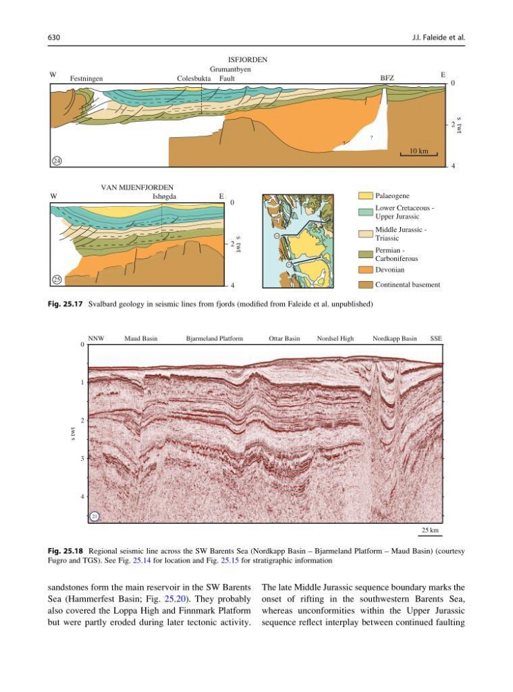
Fig. 25.17 Svalbard geology in seismic lines from fjords (modified from Faleide et al. unpublished)
0
1
2
3
4
s
twt
NNW
SSE
Bjarmeland Platform
Maud Basin
Nordkapp Basin
Nordsel High
Ottar Basin
25 km
21
Fig. 25.18 Regional seismic line across the SW Barents Sea (Nordkapp Basin – Bjarmeland Platform – Maud Basin) (courtesy
Fugro and TGS). See Fig. 25.14 for location and Fig. 25.15 for stratigraphic information
630
J.I. Faleide et al.