

and sea-level changes. The sequence is so thin that it is
generally impossible to resolve these unconformities
on the seismic data. The shales and claystones contain
thin interbedded marine dolomitic limestone and rare
siltstones or sandstones toward the basin flanks,
reflecting relatively deep and quiet marine
environments.
The Late Jurassic-earliest Cretaceous structuring in
the SW Barents Sea was characterised by regional
extension accompanied by strike-slip adjustments
along old structural lineaments, developing the
Bjørnøya, Tromsø and Harstad basins as prominent
rift basins (Fig. 25.15). The evolution of these basins
was closely linked to important tectonic phases/events
0
1
2
3
4
s
twt
SW
NE
Bjarmeland Platform
Loppa High
Veslemøy High
22
25 km
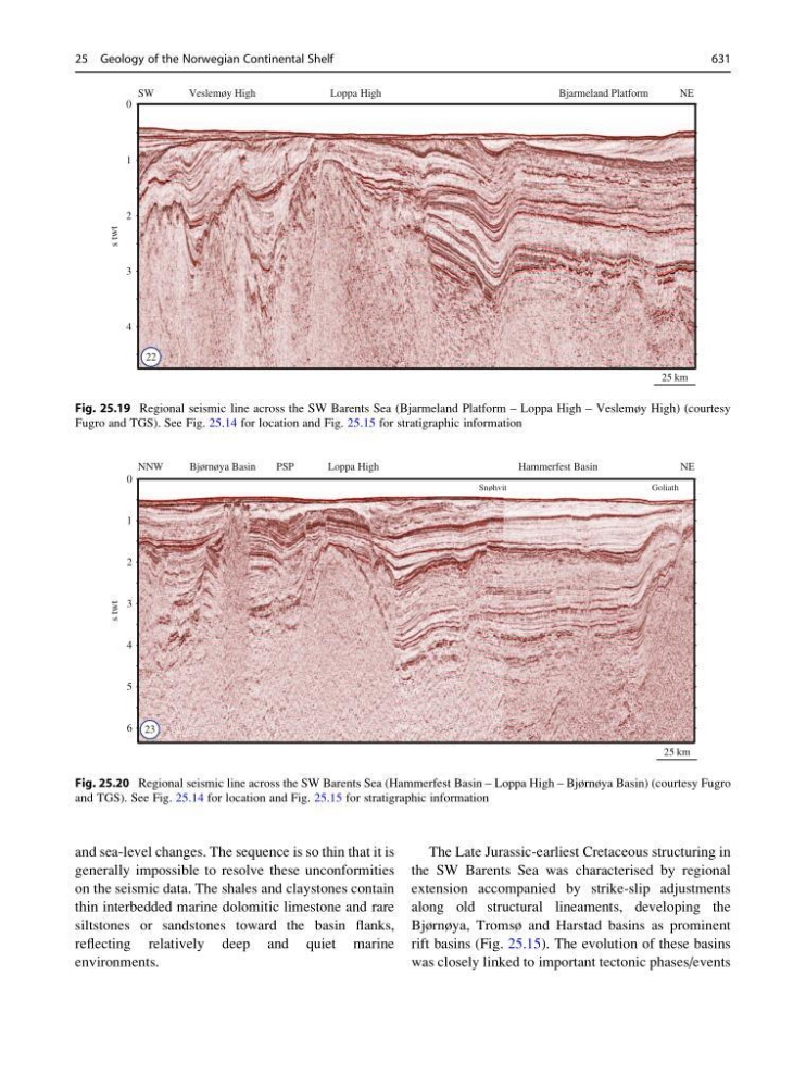
Fig. 25.19 Regional seismic line across the SW Barents Sea (Bjarmeland Platform – Loppa High – Veslemøy High) (courtesy
Fugro and TGS). See Fig. 25.14 for location and Fig. 25.15 for stratigraphic information
0
1
2
3
4
5
6
s
twt
NNW
NE
Hammerfest Basin
Loppa High
Bjørnøya Basin
Snøhvit
Goliath
PSP
25 km
23
Fig. 25.20 Regional seismic line across the SW Barents Sea (Hammerfest Basin – Loppa High – Bjørnøya Basin) (courtesy Fugro
and TGS). See Fig. 25.14 for location and Fig. 25.15 for stratigraphic information
25 Geology of the Norwegian Continental Shelf
631