

Channel�and�Bar Reservoirs (CB Type)
515
---LAST POSITION OF
' "' L O O m
5 0 0 m
0 1 5 0 0 '
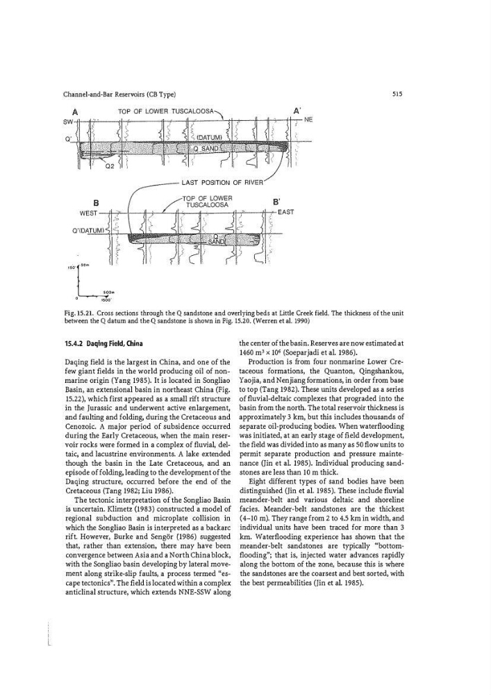
Fig. 15.21. Cross sections through the Q sandstone and overlying beds at Little Creek field. The thickness of the unit
between the Q datum and the·Q sandstone is shown in Fig. 15.20. (Werren et al. 1990)
15.4.2 Daqing Field, China
Daqing field is the largest in China, and one of the
few giant fi elds in the world producing oil of nonmarine origin (Yang 1985). It is located in Songliao
Basin, an extensional basin in northeast China (Fig.
15.22), which first appeared as a small rift structure
in the Jurassic and underwent active enlargement,
and faulting and folding, during the Cretaceous and
Cenozoic. A major period of subsidence occurred
during the Early Cretaceous, when the main reservoir rocks were formed in a complex of fluvial, deltaic, and lacustrine environments. A lake extended
though the basin in the Late Cretaceous, and an
episode of folding, leading to the development of the
Daqing structure, occurred before the end of the
Cretaceous (Tang 1982; Liu 1986).
The tectonic interpretation of the Songliao Basin
is uncertain. Klimetz (1983) constructed a model of
regional subduction and microplate collision in
which the Songliao Basin is interpreted as a backarc
rift. However, Burke and Senger (1986) suggested
that, rather than extension, there may have been
convergence between Asia and a North China block,
with the Songliao basin developing by lateral movement along strike-slip faults, a process termed "escape tectonics". The fi eld is located within a complex
anticlinal structure, which extends NNE-SSW along
the center of the basin. Reserves are now estimated at
1460 m' x 106 (Soeparjadi et al. 1986).
Production is fr om four nonmarine Lower Cretaceous formations, the Quanton, Qingshankou,
Yaojia, and Nenjiang fo rmations, in order from base
to top (Tang 1982). These units developed as a series
of fluvial-deltaic complexes that prograded into the
basin fr om the north. The total reservoir thickness is
approximately 3 km, but this includes thousands of
separate oil-producing bodies. When waterflooding
was initiated, at an early stage of fi eld development,
the fi eld was divided into as many as 50 flow units to
permit separate production and pressure maintenance ()in et al. 1985). Individual producing sandstones are less than 10 m thick.
Eight different types of sand bodies have been
distinguished ()in et al. 1985). These include fluvial
meander-belt and various deltaic and shoreline
facies. Meander-belt sandstones are the thickest
(4-10 m). They range from 2 to 4.5 km in width, and
individual units have been traced for more than 3
km. Waterflooding experience has shown that the
meander-belt sandstones are typically «bottomflooding"; that is, injected water advances rapidly
along the bottom of the zone, because this is where
the sandstones are the coarsest and best sorted, with
the best permeabilities ()in et al. 1985).