

514
SWEETWATER FIELD
\·:::::?::::;;?;;;:::::
LITTLE CREEK FIELD -90
0
-9- ...
5000 '
1500m
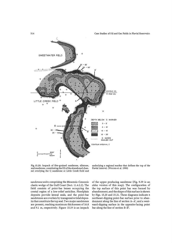
Fig. 15.20. Isopach of fi rie�grained sandstone, siltstone,
and mudstone, constituting the flll of the abandoned channel overlying the Q sandstone at Little Creek field and
sandstone units comprising the Mesozoic-Cenozoic
clastic wedge of the Gulf Coast (Sect. 11.4.2.2). The
field consists of point-bar lenses occupying the
crestal region of a low-relief anticline. Floodplain
deposits provide lateral seals, and the point-bar
sandstones are overlain by transgressive tidal deposits that constitute the top seal. Two major sandstones
are present, reaching maximum thicknesses of 16.8
and 9.1 m, respectively. Fignre 15.19 is an isopach
Case Studies of Oil and Gas Fields in Fluvial Reservoirs
DEPTH BELOW Q MARKER
Nj:;Wf:�{\':(1 o - s·
- 5-1 0'
� 10 - 15'
IB 1s - 2o·
0 SANDS
SHALED OUT
CONTOUR INTERVAL 5'
underlying a regional marker that defines the top of the
fluvial interval. (Werren et al. 1990)
of the upper producing sandstone (Fig. 9.39 is an
older version of this map). The configuration of
the top surface of this point bar was formed by
abandonment, and the shape of this surface is shown
by Figs. 15.20 and 15.21. These diagrams indicate a
northeast-dipping point-bar surface prior to abandonment along the line of section A-A', and a westward-dipping surface in the opposite-facing point
bar along the line of section B-B'.