

506
Case Studies of Oil and Gas Fields in Fluvial Reservoirs
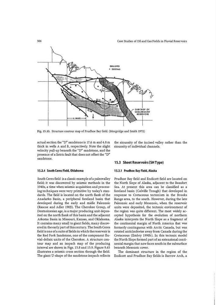
Fig. 15.10. Structure contour map of Prudhoe Bay field. (Morgridge and Smith 1972)
actual section the "D" sandstone is 17.6 m and 4.8 m
thick in wells A and B, respectively. Note the slight
velocity pull-up beneath the ('D" sandstone, and the
presence of a listric fault that does not offset the '(D"
sandstone.
15.2.4 South Ceres Field, Oklahoma
South Ceres field is a classic example of a paleovalley
field; it was discovered by seismic methods in the
1940s, a time when seismic acquisition and processing techniques were very primitive by today's standards. The field is located on the north flauk of the
Anadarko Basin, a peripheral foreland basin that
developed during the early and midle Paleozoic
(Rascoe and Adler 1983). The Cherokee Group, of
Desmoinesian age, is a major producing unit deposited on the north flauk of this basin and the adjacent
Arkoma Basin in Missouri, Kansas, and Oklahoma.
It contains many small to giant fields, many discovered in the early part of this century. The South Ceres
field is one of a suite of fields in which the reservoir is
the Red Fork Sandstone, one of the component fluvial-deltaic units of the Cherokee. A structure contour map and an isopach map of the producing
interval are shown in Figs. 15.8 and 15.9. Figure 9.45
illustrates a seismic cross section through the field.
The giant U-shape of the sandstone isopach reflects
the sinuosity of the incised valley rather than the
sinuosity of individual channels.
15.3 Sheet Reservoirs (SH Type)
1 5.3.1 Prudhoe Bay Field, Alaska
Prudhoe Bay field and Endicott field are located on
the North Slope of Alaska, adjacent to the Beaufort
Sea. At present this area can be classified as a
foreland basin (Colville Trough) that developed in
response to Cretaceous tectonism in the Brooks
Range area, to the south. Howev:er, during the late
Paleozoic and early Mesozoic, when the reservoir
units were deposited, the tectonic environment of
the region was quite different. The most widely accepted hypothesis for the evolution of northern
Alaska interprets the North Slope as a fragment of
the continental margin of North America that was
formerly continguous with Arctic Canada1 but was
rotated anticlockwise away from Canada during the
Cretaceous (Embry 199Gb). In this tectonic model
the North Slope formed part of an extensional continental margin that now faces south in the subsurface
beneath Mesozoic cover.
The dominant structure in the region of the
Endicott and Prudhoe Bay fields is Barrow Arch, a