

Paleovalley Fields (PV Type)
R IW
'
'
505
�-- �
(�·:
:
.
.
.
.
�
..
!' : ' �
. . .
...
T
22
N ·
i · : ·
,., .. �. ,_,_-'!-' .�·' -'- ' 4 · --t- ---f---t- - --t--- : ' -·-I SOUTH CERES POOL AREA
r
!
Noble Co,, Oklahoma
!le d Fork Sandsfone
.
ISOPACH
·1 , - .- -
=cJ
C. I. - 20'
P.l, lyq11.t1 71
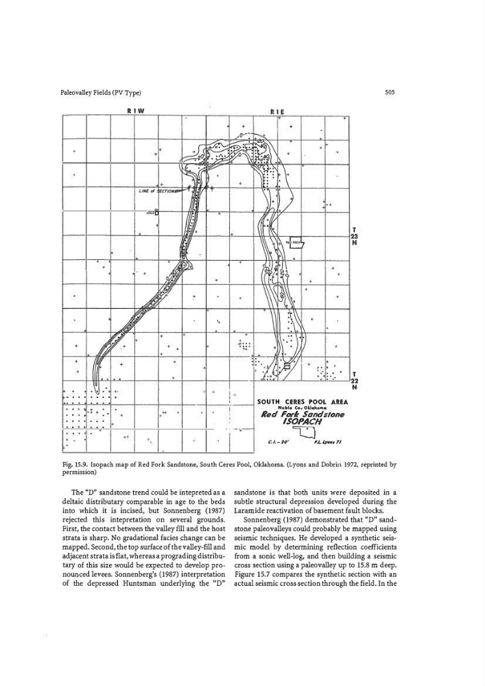
Fig. 15.9. Isopach map of Red Fork Sandstone, South Ceres Pool, Oklahoma. (Lyons and Dobriri 1972, reprinted by
permission)
The "D" sandstone trend could be intepreted as a
deltaic distributary comparable in age to the beds
into which it is incised, but Sonnenberg (1987)
rejected thjs intepretation on several grounds.
First, the contact between the valley fill and the host
strata is sharp. No gradational facies change can be
mapped. Second, the top surface of the valley-fill and
adjacent strata is flat, whereas a prograding distributary of this size would be expected to develop pronounced levees. Sonnenberg's (1987) interpretation
of the depressed Huntsman underlying the "D"
sandstone is that both units were deposited in a
subtle structural depression developed during the
Laramide reactivation of basement fault blocks.
Sonnenberg (1987) demonstrated that "D" sandstone paleovalleys could probably be mapped using
seismic techniques. He developed a synthetic seismic model by determining reflection coefficients
from a sonic well-log, and then building a seismic
cross section using a paleovalley up to 15.8 m deep.
Figure 15.7 compares the synthetic section with an
actual seismic cross section through the field. In the