

504
Case Studies of Oil and Gas Fields in Fluvial Reservoirs
R lW
RlE
I
I
��g · · . ·r:�
..
..
.\
I
!
� � � *
•
� � \ �
:�
\
• i
•
T
23
N
� I j} / · ·; I I I
.
\ 1 \
.
\� , \\' \\ \
... '(t)
... .... " '> •• : '>
•
•
! <:;)
...
.
...
.
.. �
.
.
•
•
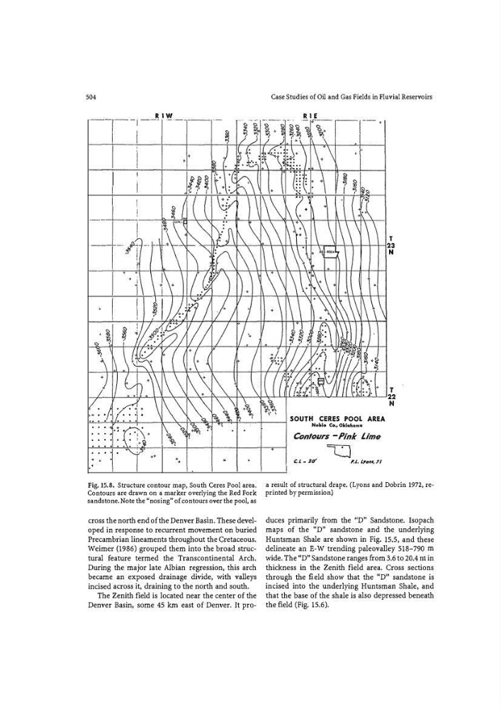
Fig. 15.8. Structure contour map, South Ceres Pool area.
Contours are drawn on a marker overlying the Red Fork
sandstone. Note the "nosing" of contours over the pool, as
cross the north end of the Denver Basin. These developed in response to recurrent movement on buried
Precambrian lineaments throughout the Cretaceous.
Weimer (1986) grouped them into the broad structural feature termed the Transcontinental Arch.
During the major late Albian regression, this arch
became an exposed drainage divide, with valleys
incised across it, draining to the north and south.
The Zenith field is located near the center of the
Denver Basin, some 45 km east of Denver. It pro�
C. I. - 20"
P.l.. l.y�JtS, 71
a result of structural drape. (Lyons and Dobrin 1972, reprinted by permission)
duces primarily from the 1'D" Sandstone. Isopach
maps of the "D" sandstone and the underlying
Huntsman Shale are shown in Fig. 15.5, and these
delineate an E-W trending paleovalley 518-790 m
wide. The "D'' Sandstone ranges from 3.6 to 20.4 rrt in
thickness in the Zenith field area. Cross sections
through the field show that the "D" sandstone is
incised into the un d erlying Huntsman Shale, and
that the base of the shale is also depressed beneath
the field (Fig. 15.6).