

Plate� Tectonic Setting of Alluvial Basins
2ooo{n.
Q OIL PRODUCTION
<--- -- APPROX. 60 M!LES---- -- --+
Oepocenter
0 G"AS PROOl/CriON
KENAI- CHUGACH MTS.
SOURCE PREDOMINANT
391
SE
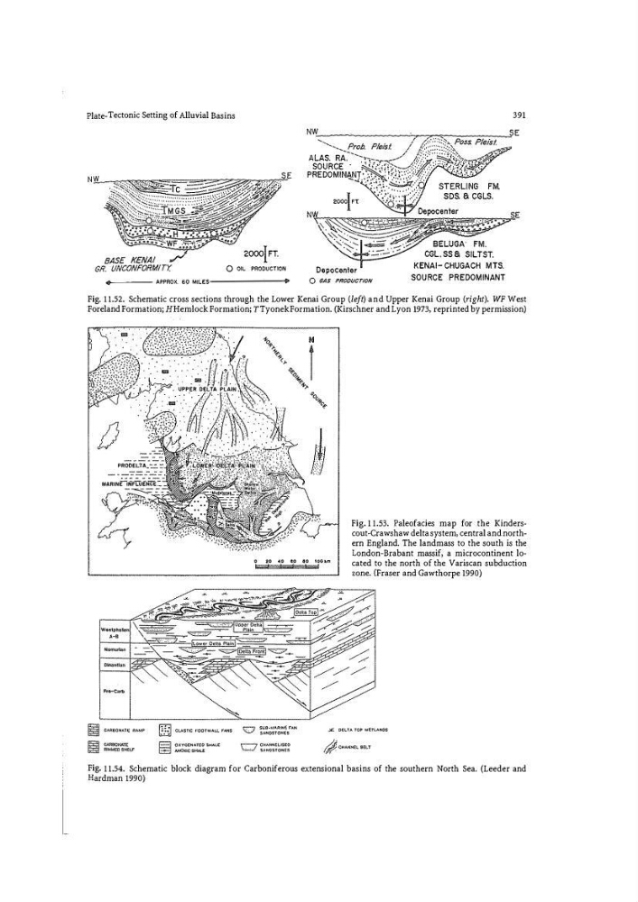
Fig. 11.52. Schematic cross sections through the Lower Kenai Group (left) and Upper Kenai Group (right). WF West
Foreland Formation; H Hemlock Formation; TTyonek Formation. (Kirschner and Lyon 1973, reprinted by permission)
� CLASTtC t-OOTWALL FANS
E"J OXV<.l�NAT�O SKAtE
8 ANOXiC SHAUi
0
20 40 80 80 IOOkm
Fig. 11.53. Paleofacies map for the Kinders�
cout-Crawshaw delta system� central and north"
ern England. The landmass to the south is the
London-Brabant massif, a microcontinent located to the north of the Variscan subduction
zone. {Fraser and Gawthorpe 1990)
SU9·UAiliNE fAN
$AN0STONGS
r--7 CtMNN�L!S�O
\.;...:_/ S�NOSTONE$
.:£. O€tTA TOP W€TVNOS
Fig. 11.54. Schematic block diagram for Carboniferous extensional basins of the southern North Sea. (Leeder and
Hardman 1990)
2ooo{n.
Q OIL PRODUCTION
<--- -- APPROX. 60 M!LES---- -- --+
Oepocenter
0 G"AS PROOl/CriON
KENAI- CHUGACH MTS.
SOURCE PREDOMINANT
391
SE
Fig. 11.52. Schematic cross sections through the Lower Kenai Group (left) and Upper Kenai Group (right). WF West
Foreland Formation; H Hemlock Formation; TTyonek Formation. (Kirschner and Lyon 1973, reprinted by permission)
� CLASTtC t-OOTWALL FANS
E"J OXV<.l�NAT�O SKAtE
8 ANOXiC SHAUi
0
20 40 80 80 IOOkm
Fig. 11.53. Paleofacies map for the Kinders�
cout-Crawshaw delta system� central and north"
ern England. The landmass to the south is the
London-Brabant massif, a microcontinent located to the north of the Variscan subduction
zone. {Fraser and Gawthorpe 1990)
SU9·UAiliNE fAN
$AN0STONGS
r--7 CtMNN�L!S�O
\.;...:_/ S�NOSTONE$
.:£. O€tTA TOP W€TVNOS
Fig. 11.54. Schematic block diagram for Carboniferous extensional basins of the southern North Sea. (Leeder and
Hardman 1990)