

source and method, by extending the scope of the year of analysis to cover recent
fires and re-analyzing burnt area data (Fig. 15.5). Following the spatial analysis of
burnt area of peatlands, there is an opportunity to improve the estimates of GHGs
emission resulted from peatland fires, as the burnt area can be differentiated into
areas with the first fire and areas with recurrent fires (second, third, subsequent fires,
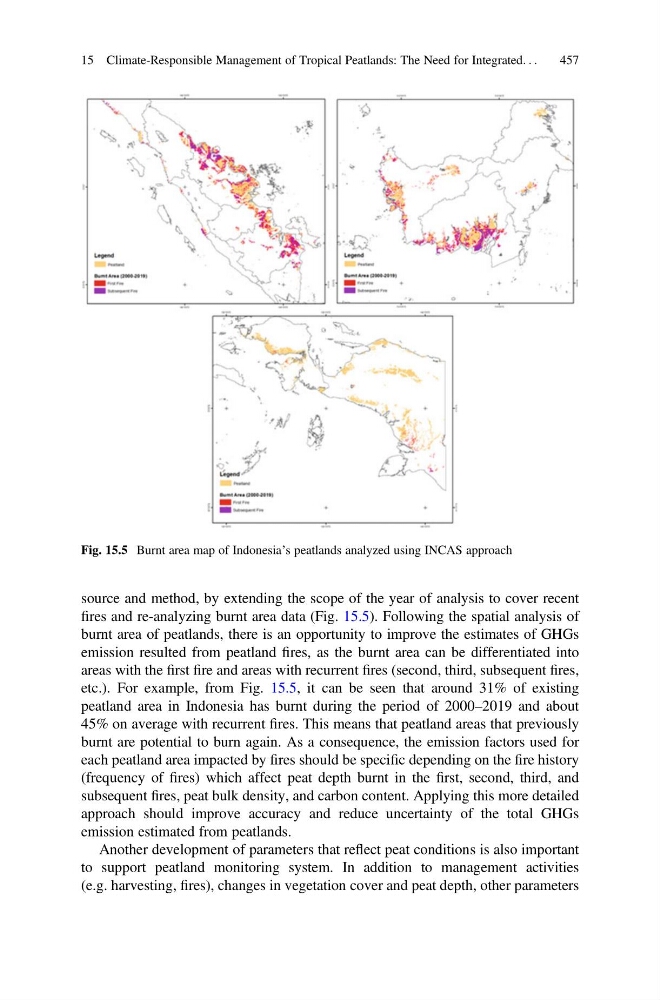
etc.). For example, from Fig. 15.5, it can be seen that around 31% of existing
peatland area in Indonesia has burnt during the period of 2000–2019 and about
45% on average with recurrent fires. This means that peatland areas that previously
burnt are potential to burn again. As a consequence, the emission factors used for
each peatland area impacted by fires should be specific depending on the fire history
(frequency of fires) which affect peat depth burnt in the first, second, third, and
subsequent fires, peat bulk density, and carbon content. Applying this more detailed
approach should improve accuracy and reduce uncertainty of the total GHGs
emission estimated from peatlands.
Another development of parameters that reflect peat conditions is also important
to support peatland monitoring system. In addition to management activities
(e.g. harvesting, fires), changes in vegetation cover and peat depth, other parameters
Fig. 15.5 Burnt area map of Indonesia’s peatlands analyzed using INCAS approach
15 Climate-Responsible Management of Tropical Peatlands: The Need for Integrated. . .
457
fires and re-analyzing burnt area data (Fig. 15.5). Following the spatial analysis of
burnt area of peatlands, there is an opportunity to improve the estimates of GHGs
emission resulted from peatland fires, as the burnt area can be differentiated into
areas with the first fire and areas with recurrent fires (second, third, subsequent fires,
etc.). For example, from Fig. 15.5, it can be seen that around 31% of existing
peatland area in Indonesia has burnt during the period of 2000–2019 and about
45% on average with recurrent fires. This means that peatland areas that previously
burnt are potential to burn again. As a consequence, the emission factors used for
each peatland area impacted by fires should be specific depending on the fire history
(frequency of fires) which affect peat depth burnt in the first, second, third, and
subsequent fires, peat bulk density, and carbon content. Applying this more detailed
approach should improve accuracy and reduce uncertainty of the total GHGs
emission estimated from peatlands.
Another development of parameters that reflect peat conditions is also important
to support peatland monitoring system. In addition to management activities
(e.g. harvesting, fires), changes in vegetation cover and peat depth, other parameters
Fig. 15.5 Burnt area map of Indonesia’s peatlands analyzed using INCAS approach
15 Climate-Responsible Management of Tropical Peatlands: The Need for Integrated. . .
457