

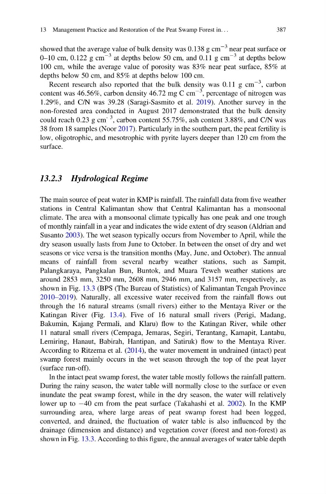
showed that the average value of bulk density was 0.138 g cm
À3 near peat surface or
0–10 cm, 0.122 g cm
À3 at depths below 50 cm, and 0.11 g cm
À3 at depths below
100 cm, while the average value of porosity was 83% near peat surface, 85% at
depths below 50 cm, and 85% at depths below 100 cm.
Recent research also reported that the bulk density was 0.11 g cm
À3 , carbon
content was 46.56%, carbon density 46.72 mg C cm
À3 , percentage of nitrogen was
1.29%, and C/N was 39.28 (Saragi-Sasmito et al. 2019). Another survey in the
non-forested area conducted in August 2017 demonstrated that the bulk density
could reach 0.23 g cm
- 3 , carbon content 55.75%, ash content 3.88%, and C/N was
38 from 18 samples (Noor 2017). Particularly in the southern part, the peat fertility is
low, oligotrophic, and mesotrophic with pyrite layers deeper than 120 cm from the
surface.
13.2.3 Hydrological Regime
The main source of peat water in KMP is rainfall. The rainfall data from five weather
stations in Central Kalimantan show that Central Kalimantan has a monsoonal
climate. The area with a monsoonal climate typically has one peak and one trough
of monthly rainfall in a year and indicates the wide extent of dry season (Aldrian and
Susanto 2003). The wet season typically occurs from November to April, while the
dry season usually lasts from June to October. In between the onset of dry and wet
seasons or vice versa is the transition months (May, June, and October). The annual
means of rainfall from several nearby weather stations, such as Sampit,
Palangkaraya, Pangkalan Bun, Buntok, and Muara Teweh weather stations are
around 2853 mm, 3250 mm, 2608 mm, 2946 mm, and 3157 mm, respectively, as
shown in Fig. 13.3 (BPS (The Bureau of Statistics) of Kalimantan Tengah Province
2010–2019). Naturally, all excessive water received from the rainfall flows out
through the 16 natural streams (small rivers) either to the Mentaya River or the
Katingan River (Fig. 13.4). Five of 16 natural small rivers (Perigi, Madang,
Bakumin, Kajang Permali, and Klaru) flow to the Katingan River, while other
11 natural small rivers (Cempaga, Jemaras, Segiri, Terantang, Kamapit, Lantabu,
Lemiring, Hanaut, Babirah, Hantipan, and Satiruk) flow to the Mentaya River.
According to Ritzema et al. (2014), the water movement in undrained (intact) peat
swamp forest mainly occurs in the wet season through the top of the peat layer
(surface run-off).
In the intact peat swamp forest, the water table mostly follows the rainfall pattern.
During the rainy season, the water table will normally close to the surface or even
inundate the peat swamp forest, while in the dry season, the water will relatively
lower up to À40 cm from the peat surface (Takahashi et al. 2002). In the KMP
surrounding area, where large areas of peat swamp forest had been logged,
converted, and drained, the fluctuation of water table is also influenced by the
drainage (dimension and distance) and vegetation cover (forest and non-forest) as
shown in Fig. 13.3. According to this figure, the annual averages of water table depth
13 Management Practice and Restoration of the Peat Swamp Forest in. . .
387
À3 near peat surface or
0–10 cm, 0.122 g cm
À3 at depths below 50 cm, and 0.11 g cm
À3 at depths below
100 cm, while the average value of porosity was 83% near peat surface, 85% at
depths below 50 cm, and 85% at depths below 100 cm.
Recent research also reported that the bulk density was 0.11 g cm
À3 , carbon
content was 46.56%, carbon density 46.72 mg C cm
À3 , percentage of nitrogen was
1.29%, and C/N was 39.28 (Saragi-Sasmito et al. 2019). Another survey in the
non-forested area conducted in August 2017 demonstrated that the bulk density
could reach 0.23 g cm
- 3 , carbon content 55.75%, ash content 3.88%, and C/N was
38 from 18 samples (Noor 2017). Particularly in the southern part, the peat fertility is
low, oligotrophic, and mesotrophic with pyrite layers deeper than 120 cm from the
surface.
13.2.3 Hydrological Regime
The main source of peat water in KMP is rainfall. The rainfall data from five weather
stations in Central Kalimantan show that Central Kalimantan has a monsoonal
climate. The area with a monsoonal climate typically has one peak and one trough
of monthly rainfall in a year and indicates the wide extent of dry season (Aldrian and
Susanto 2003). The wet season typically occurs from November to April, while the
dry season usually lasts from June to October. In between the onset of dry and wet
seasons or vice versa is the transition months (May, June, and October). The annual
means of rainfall from several nearby weather stations, such as Sampit,
Palangkaraya, Pangkalan Bun, Buntok, and Muara Teweh weather stations are
around 2853 mm, 3250 mm, 2608 mm, 2946 mm, and 3157 mm, respectively, as
shown in Fig. 13.3 (BPS (The Bureau of Statistics) of Kalimantan Tengah Province
2010–2019). Naturally, all excessive water received from the rainfall flows out
through the 16 natural streams (small rivers) either to the Mentaya River or the
Katingan River (Fig. 13.4). Five of 16 natural small rivers (Perigi, Madang,
Bakumin, Kajang Permali, and Klaru) flow to the Katingan River, while other
11 natural small rivers (Cempaga, Jemaras, Segiri, Terantang, Kamapit, Lantabu,
Lemiring, Hanaut, Babirah, Hantipan, and Satiruk) flow to the Mentaya River.
According to Ritzema et al. (2014), the water movement in undrained (intact) peat
swamp forest mainly occurs in the wet season through the top of the peat layer
(surface run-off).
In the intact peat swamp forest, the water table mostly follows the rainfall pattern.
During the rainy season, the water table will normally close to the surface or even
inundate the peat swamp forest, while in the dry season, the water will relatively
lower up to À40 cm from the peat surface (Takahashi et al. 2002). In the KMP
surrounding area, where large areas of peat swamp forest had been logged,
converted, and drained, the fluctuation of water table is also influenced by the
drainage (dimension and distance) and vegetation cover (forest and non-forest) as
shown in Fig. 13.3. According to this figure, the annual averages of water table depth
13 Management Practice and Restoration of the Peat Swamp Forest in. . .
387