

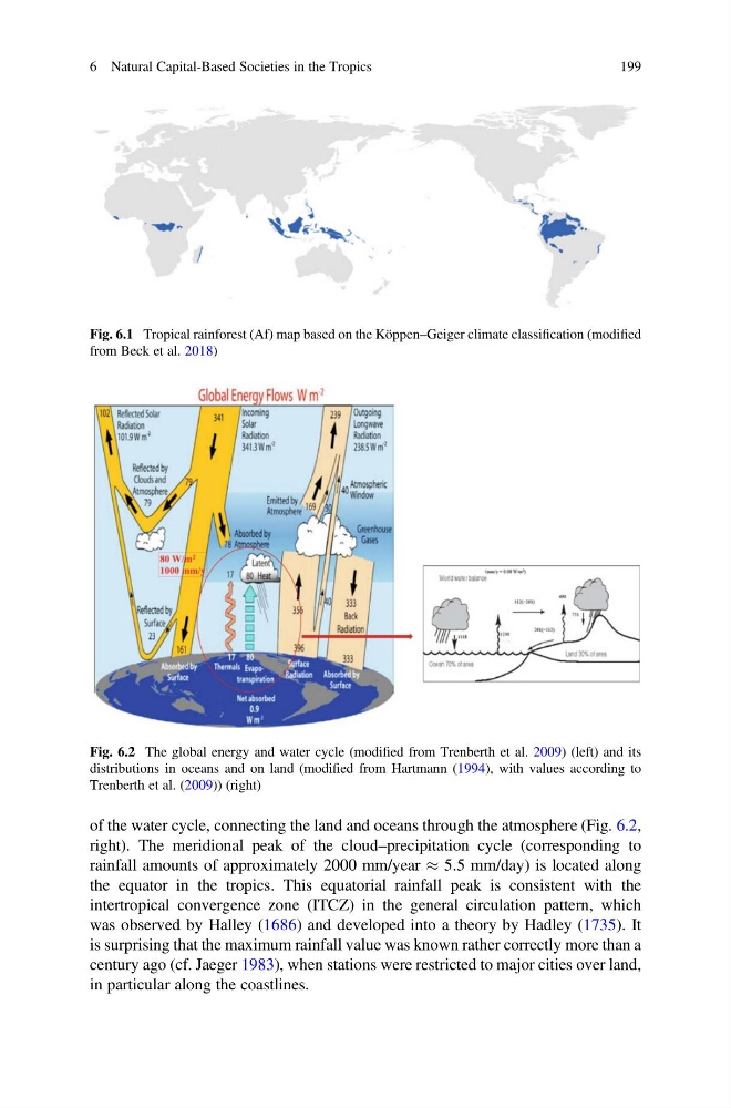
of the water cycle, connecting the land and oceans through the atmosphere (Fig. 6.2,
right). The meridional peak of the cloud–precipitation cycle (corresponding to
rainfall amounts of approximately 2000 mm/year % 5.5 mm/day) is located along
the equator in the tropics. This equatorial rainfall peak is consistent with the
intertropical convergence zone (ITCZ) in the general circulation pattern, which
was observed by Halley (1686) and developed into a theory by Hadley (1735). It
is surprising that the maximum rainfall value was known rather correctly more than a
century ago (cf. Jaeger 1983), when stations were restricted to major cities over land,
in particular along the coastlines.
Fig. 6.1 Tropical rainforest (Af) map based on the Köppen–Geiger climate classification (modified
from Beck et al. 2018)
Fig. 6.2 The global energy and water cycle (modified from Trenberth et al. 2009) (left) and its
distributions in oceans and on land (modified from Hartmann (1994), with values according to
Trenberth et al. (2009)) (right)
6 Natural Capital-Based Societies in the Tropics
199
right). The meridional peak of the cloud–precipitation cycle (corresponding to
rainfall amounts of approximately 2000 mm/year % 5.5 mm/day) is located along
the equator in the tropics. This equatorial rainfall peak is consistent with the
intertropical convergence zone (ITCZ) in the general circulation pattern, which
was observed by Halley (1686) and developed into a theory by Hadley (1735). It
is surprising that the maximum rainfall value was known rather correctly more than a
century ago (cf. Jaeger 1983), when stations were restricted to major cities over land,
in particular along the coastlines.
Fig. 6.1 Tropical rainforest (Af) map based on the Köppen–Geiger climate classification (modified
from Beck et al. 2018)
Fig. 6.2 The global energy and water cycle (modified from Trenberth et al. 2009) (left) and its
distributions in oceans and on land (modified from Hartmann (1994), with values according to
Trenberth et al. (2009)) (right)
6 Natural Capital-Based Societies in the Tropics
199