

Future Utilization of
HISUI Hyper
30 m spatial resolution
@ 10-12.5 nm, 185 bands
Biodiversity Mapping
Forest Degradation
Mapping
Map
Leaf Water Potential
Mapping
Water potential
WBI
Dissolved Organic Carbon
(DOC) Mapping
Crop Growth Stage
Mapping
500g/m 2
750g/m 2
R:ch35, G:ch18, B:ch5
Crop Yield Mapping
Disease Mapping
(Early detection of rice blast)
Micro Satellite
䠄Hyper-spectral
sensor䠅
Biomass Mapping
RedʁDead trees
Green-YellowʁWater stressed
trees
Vegetative early
Vegetative mid
Vegetative late
Reproductive early
Reproductive mid
Reproductive late
Ripening early
Ripening mid
Ripening late
Degree of Risk
High
Low
Drone
ʤLCTFʥ
(METI/J-Spacesystems)
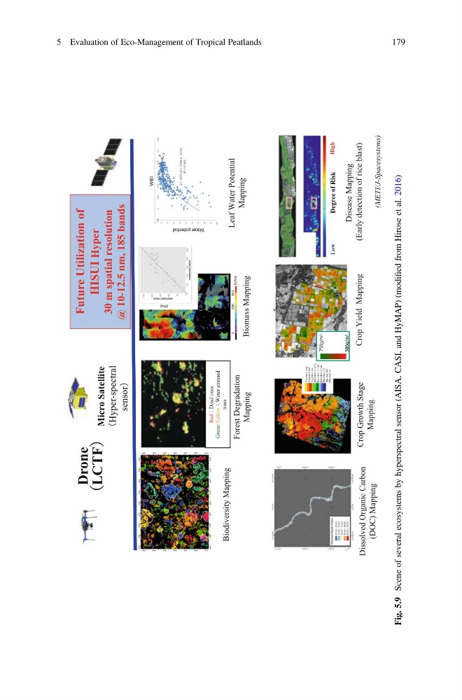
Fig. 5.9
Scene of several ecosystems by hyperspectral sensor (AISA, CASI, and HyMAP) (modified from Hirose et al. 2016)
5 Evaluation of Eco-Management of Tropical Peatlands
179
HISUI Hyper
30 m spatial resolution
@ 10-12.5 nm, 185 bands
Biodiversity Mapping
Forest Degradation
Mapping
Map
Leaf Water Potential
Mapping
Water potential
WBI
Dissolved Organic Carbon
(DOC) Mapping
Crop Growth Stage
Mapping
500g/m 2
750g/m 2
R:ch35, G:ch18, B:ch5
Crop Yield Mapping
Disease Mapping
(Early detection of rice blast)
Micro Satellite
䠄Hyper-spectral
sensor䠅
Biomass Mapping
RedʁDead trees
Green-YellowʁWater stressed
trees
Vegetative early
Vegetative mid
Vegetative late
Reproductive early
Reproductive mid
Reproductive late
Ripening early
Ripening mid
Ripening late
Degree of Risk
High
Low
Drone
ʤLCTFʥ
(METI/J-Spacesystems)
Fig. 5.9
Scene of several ecosystems by hyperspectral sensor (AISA, CASI, and HyMAP) (modified from Hirose et al. 2016)
5 Evaluation of Eco-Management of Tropical Peatlands
179