

studies. However, this approach is time-consuming, labor-intensive, and costly if it
is to be implemented on a landscape scale. This method also implemented by
WSL-MTI to collect the topographic information in the given management area
before starting the operation. However, because management of tropical peatlands
requires a simple, low cost, and easy-to-maintain technology for implementation on
a landscape scale, the unmanned aerial system (UAS) is one of the options for rapid
assembly of topographic information. Therefore, WSL-MTI is developing a new
technology for collection of topographic information using an UAV system.
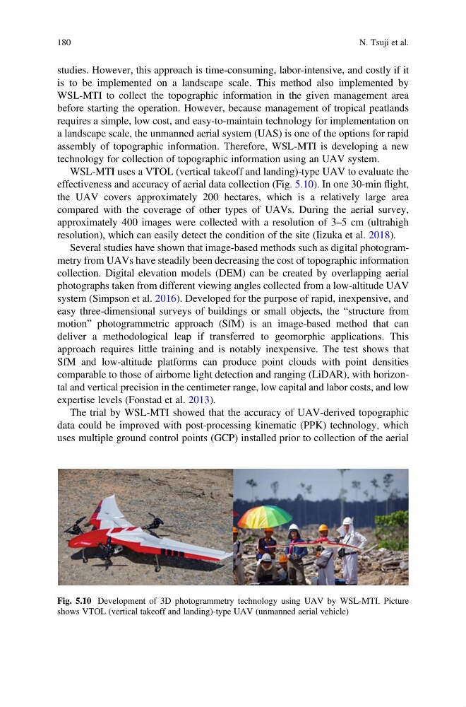
WSL-MTI uses a VTOL (vertical takeoff and landing)-type UAV to evaluate the
effectiveness and accuracy of aerial data collection (Fig. 5.10). In one 30-min flight,
the UAV covers approximately 200 hectares, which is a relatively large area
compared with the coverage of other types of UAVs. During the aerial survey,
approximately 400 images were collected with a resolution of 3–5 cm (ultrahigh
resolution), which can easily detect the condition of the site (Iizuka et al. 2018).
Several studies have shown that image-based methods such as digital photogrammetry from UAVs have steadily been decreasing the cost of topographic information
collection. Digital elevation models (DEM) can be created by overlapping aerial
photographs taken from different viewing angles collected from a low-altitude UAV
system (Simpson et al. 2016). Developed for the purpose of rapid, inexpensive, and
easy three-dimensional surveys of buildings or small objects, the “structure from
motion” photogrammetric approach (SfM) is an image-based method that can
deliver a methodological leap if transferred to geomorphic applications. This
approach requires little training and is notably inexpensive. The test shows that
SfM and low-altitude platforms can produce point clouds with point densities
comparable to those of airborne light detection and ranging (LiDAR), with horizontal and vertical precision in the centimeter range, low capital and labor costs, and low
expertise levels (Fonstad et al. 2013).
The trial by WSL-MTI showed that the accuracy of UAV-derived topographic
data could be improved with post-processing kinematic (PPK) technology, which
uses multiple ground control points (GCP) installed prior to collection of the aerial
Fig. 5.10 Development of 3D photogrammetry technology using UAV by WSL-MTI. Picture
shows VTOL (vertical takeoff and landing)-type UAV (unmanned aerial vehicle)
180
N. Tsuji et al.
is to be implemented on a landscape scale. This method also implemented by
WSL-MTI to collect the topographic information in the given management area
before starting the operation. However, because management of tropical peatlands
requires a simple, low cost, and easy-to-maintain technology for implementation on
a landscape scale, the unmanned aerial system (UAS) is one of the options for rapid
assembly of topographic information. Therefore, WSL-MTI is developing a new
technology for collection of topographic information using an UAV system.
WSL-MTI uses a VTOL (vertical takeoff and landing)-type UAV to evaluate the
effectiveness and accuracy of aerial data collection (Fig. 5.10). In one 30-min flight,
the UAV covers approximately 200 hectares, which is a relatively large area
compared with the coverage of other types of UAVs. During the aerial survey,
approximately 400 images were collected with a resolution of 3–5 cm (ultrahigh
resolution), which can easily detect the condition of the site (Iizuka et al. 2018).
Several studies have shown that image-based methods such as digital photogrammetry from UAVs have steadily been decreasing the cost of topographic information
collection. Digital elevation models (DEM) can be created by overlapping aerial
photographs taken from different viewing angles collected from a low-altitude UAV
system (Simpson et al. 2016). Developed for the purpose of rapid, inexpensive, and
easy three-dimensional surveys of buildings or small objects, the “structure from
motion” photogrammetric approach (SfM) is an image-based method that can
deliver a methodological leap if transferred to geomorphic applications. This
approach requires little training and is notably inexpensive. The test shows that
SfM and low-altitude platforms can produce point clouds with point densities
comparable to those of airborne light detection and ranging (LiDAR), with horizontal and vertical precision in the centimeter range, low capital and labor costs, and low
expertise levels (Fonstad et al. 2013).
The trial by WSL-MTI showed that the accuracy of UAV-derived topographic
data could be improved with post-processing kinematic (PPK) technology, which
uses multiple ground control points (GCP) installed prior to collection of the aerial
Fig. 5.10 Development of 3D photogrammetry technology using UAV by WSL-MTI. Picture
shows VTOL (vertical takeoff and landing)-type UAV (unmanned aerial vehicle)
180
N. Tsuji et al.