

3.8.1 Topography Survey
A detailed topographic map is needed to support the hydrological understanding of
the target area, such as the location and extent of the peat dome, as well as the
elevation and slope. With the information, a plan for the water management system
was formulated before starting the plantation activities. In designing a detailed plan
to prevent impact on peat ecosystems, WSL-MTI required a contour map with
intervals of 0.5 m.
A plan of topographic surveys should be designed to determine the small and
large changes in elevation. WSL-MTI conducted ground surveys to produce the
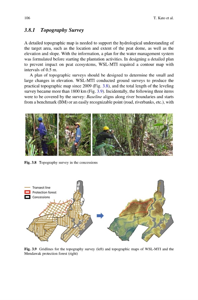
practical topographic map since 2009 (Fig. 3.8), and the total length of the leveling
survey became more than 1800 km (Fig. 3.9). Incidentally, the following three items
were to be covered by the survey: Baseline aligns along river boundaries and starts
from a benchmark (BM) or an easily recognizable point (road, riverbanks, etc.), with
Fig. 3.8 Topography survey in the concessions
Fig. 3.9 Gridlines for the topography survey (left) and topographic maps of WSL-MTI and the
Mendawak protection forest (right)
106
T. Kato et al.
A detailed topographic map is needed to support the hydrological understanding of
the target area, such as the location and extent of the peat dome, as well as the
elevation and slope. With the information, a plan for the water management system
was formulated before starting the plantation activities. In designing a detailed plan
to prevent impact on peat ecosystems, WSL-MTI required a contour map with
intervals of 0.5 m.
A plan of topographic surveys should be designed to determine the small and
large changes in elevation. WSL-MTI conducted ground surveys to produce the
practical topographic map since 2009 (Fig. 3.8), and the total length of the leveling
survey became more than 1800 km (Fig. 3.9). Incidentally, the following three items
were to be covered by the survey: Baseline aligns along river boundaries and starts
from a benchmark (BM) or an easily recognizable point (road, riverbanks, etc.), with
Fig. 3.8 Topography survey in the concessions
Fig. 3.9 Gridlines for the topography survey (left) and topographic maps of WSL-MTI and the
Mendawak protection forest (right)
106
T. Kato et al.