

index was 97.083. Hence, 2009 was a year of
distinct hyper-arid conditions.
The actual annual precipitation and potential
evapotranspiration analysis for the period 2004
to 2009 helped to identify and demarcate the
hyper-arid areas of the Indian Desert. The
meteorological analysis verified that all the years
recorded the annual aridity index ranging from
95.652 expressed as percentage of 97.083.
Hence, all the years recorded an annual aridity
index of 95 or higher as per the climatic classification scheme of Kafle and Bruins. The analysis reveals a regularly occurring hyper-arid
condition along the narrow western margin of the
Indian Desert. The hyper-aridity of the study area
has been validated.
17.3.2 Botanical Basis
For the identification and demarcation of the
hyper-arid areas in the Indian Desert, the
researcher has additionally employed the Koppen’s eternal botanical index for the demarcation
of hyper-arid areas. As per the present demarcation, the hyper-arid areas of the Indian Desert
have two unique identification features.
Botanically, the drastic floral changes in the
form of disappearance of the tree line are another
basis of the identification and demarcation of
hyper-arid zone in the Indian Desert. All the
areas of Indian Desert are dotted with versatile
and robust Prosopis cineraria—a tree locally
called Khejri. A sudden disappearance of this
tree including the shrubs is a botanical evidence
of the encroaching hyper-arid conditions. There
is no tree growth or shrubs in the hyper-arid areas
of the Indian Desert. Only extremely droughtresistant annuals, biennials, ephemerals and
grasses sustain. Drought-resistant grasses have
been acknowledged as hyper-arid.
17.3.3 Hydrographic Basis
There are a number of evidences to support the
view that the genesis of hyper-arid lands in the
Indian Desert lies to the hydrographic changes in
the form of shift and disappearance of the palaeo
drainage systems. A network of palaeochannels
is testimony to the organised drainage system in
the areas where the hyper-arid lands lie as well as
other arid lands of the Thar desert.
A large part of the region is covered by
Aeolian sand and alluvium and is devoid of any
other perennial drainage system. Late quaternary
climatic changes and neotectonics have significantly modified the drainage courses in the
region to form a large number of palaeochannels.
Palaeochannels are remnants of stream channels
cut in older rocks/sediments and filled by
younger overlying sediments. The palaeochannels of Saraswati coincide with the dry bed of
present-day Ghaggar.
The Luni was a tributary to the Himalayan
river Saraswati and the confluence of these two
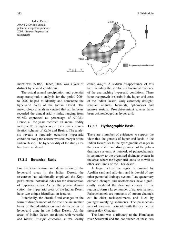
Fig. 17.10 Indian Desert:
Above 2400 mm annual
potential evapotranspiration,
2009. (Source Prepared by
researcher)
232
S. Salahuddin
distinct hyper-arid conditions.
The actual annual precipitation and potential
evapotranspiration analysis for the period 2004
to 2009 helped to identify and demarcate the
hyper-arid areas of the Indian Desert. The
meteorological analysis verified that all the years
recorded the annual aridity index ranging from
95.652 expressed as percentage of 97.083.
Hence, all the years recorded an annual aridity
index of 95 or higher as per the climatic classification scheme of Kafle and Bruins. The analysis reveals a regularly occurring hyper-arid
condition along the narrow western margin of the
Indian Desert. The hyper-aridity of the study area
has been validated.
17.3.2 Botanical Basis
For the identification and demarcation of the
hyper-arid areas in the Indian Desert, the
researcher has additionally employed the Koppen’s eternal botanical index for the demarcation
of hyper-arid areas. As per the present demarcation, the hyper-arid areas of the Indian Desert
have two unique identification features.
Botanically, the drastic floral changes in the
form of disappearance of the tree line are another
basis of the identification and demarcation of
hyper-arid zone in the Indian Desert. All the
areas of Indian Desert are dotted with versatile
and robust Prosopis cineraria—a tree locally
called Khejri. A sudden disappearance of this
tree including the shrubs is a botanical evidence
of the encroaching hyper-arid conditions. There
is no tree growth or shrubs in the hyper-arid areas
of the Indian Desert. Only extremely droughtresistant annuals, biennials, ephemerals and
grasses sustain. Drought-resistant grasses have
been acknowledged as hyper-arid.
17.3.3 Hydrographic Basis
There are a number of evidences to support the
view that the genesis of hyper-arid lands in the
Indian Desert lies to the hydrographic changes in
the form of shift and disappearance of the palaeo
drainage systems. A network of palaeochannels
is testimony to the organised drainage system in
the areas where the hyper-arid lands lie as well as
other arid lands of the Thar desert.
A large part of the region is covered by
Aeolian sand and alluvium and is devoid of any
other perennial drainage system. Late quaternary
climatic changes and neotectonics have significantly modified the drainage courses in the
region to form a large number of palaeochannels.
Palaeochannels are remnants of stream channels
cut in older rocks/sediments and filled by
younger overlying sediments. The palaeochannels of Saraswati coincide with the dry bed of
present-day Ghaggar.
The Luni was a tributary to the Himalayan
river Saraswati and the confluence of these two
Fig. 17.10 Indian Desert:
Above 2400 mm annual
potential evapotranspiration,
2009. (Source Prepared by
researcher)
232
S. Salahuddin