

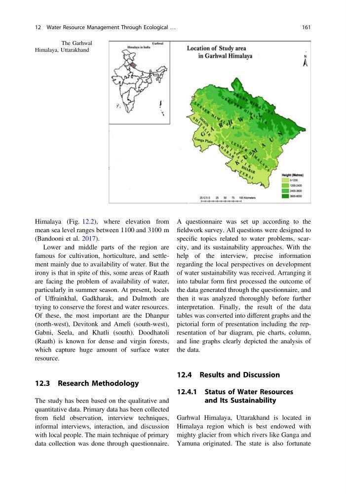
Himalaya (Fig. 12.2), where elevation from
mean sea level ranges between 1100 and 3100 m
(Bandooni et al. 2017).
Lower and middle parts of the region are
famous for cultivation, horticulture, and settlement mainly due to availability of water. But the
irony is that in spite of this, some areas of Raath
are facing the problem of availability of water,
particularly in summer season. At present, locals
of Uffrainkhal, Gadkharak, and Dulmoth are
trying to conserve the forest and water resources.
Of these, the most important are the Dhanpur
(north-west), Devitonk and Ameli (south-west),
Gabni, Seela, and Khatli (south). Doodhatoli
(Raath) is known for dense and virgin forests,
which capture huge amount of surface water
resource.
12.3 Research Methodology
The study has been based on the qualitative and
quantitative data. Primary data has been collected
from field observation, interview techniques,
informal interviews, interaction, and discussion
with local people. The main technique of primary
data collection was done through questionnaire.
A questionnaire was set up according to the
fieldwork survey. All questions were designed to
specific topics related to water problems, scarcity, and its sustainability approaches. With the
help of the interview, precise information
regarding the local perspectives on development
of water sustainability was received. Arranging it
into tabular form first processed the outcome of
the data generated through the questionnaire, and
then it was analyzed thoroughly before further
interpretation. Finally, the result of the data
tables was converted into different graphs and the
pictorial form of presentation including the representation of bar diagram, pie charts, column,
and line graphs clearly depicted the analysis of
the data.
12.4 Results and Discussion
12.4.1 Status of Water Resources
and Its Sustainability
Garhwal Himalaya, Uttarakhand is located in
Himalaya region which is best endowed with
mighty glacier from which rivers like Ganga and
Yamuna originated. The state is also fortunate
Fig. 12.2 The Garhwal
Himalaya, Uttarakhand
12 Water Resource Management Through Ecological …
161
mean sea level ranges between 1100 and 3100 m
(Bandooni et al. 2017).
Lower and middle parts of the region are
famous for cultivation, horticulture, and settlement mainly due to availability of water. But the
irony is that in spite of this, some areas of Raath
are facing the problem of availability of water,
particularly in summer season. At present, locals
of Uffrainkhal, Gadkharak, and Dulmoth are
trying to conserve the forest and water resources.
Of these, the most important are the Dhanpur
(north-west), Devitonk and Ameli (south-west),
Gabni, Seela, and Khatli (south). Doodhatoli
(Raath) is known for dense and virgin forests,
which capture huge amount of surface water
resource.
12.3 Research Methodology
The study has been based on the qualitative and
quantitative data. Primary data has been collected
from field observation, interview techniques,
informal interviews, interaction, and discussion
with local people. The main technique of primary
data collection was done through questionnaire.
A questionnaire was set up according to the
fieldwork survey. All questions were designed to
specific topics related to water problems, scarcity, and its sustainability approaches. With the
help of the interview, precise information
regarding the local perspectives on development
of water sustainability was received. Arranging it
into tabular form first processed the outcome of
the data generated through the questionnaire, and
then it was analyzed thoroughly before further
interpretation. Finally, the result of the data
tables was converted into different graphs and the
pictorial form of presentation including the representation of bar diagram, pie charts, column,
and line graphs clearly depicted the analysis of
the data.
12.4 Results and Discussion
12.4.1 Status of Water Resources
and Its Sustainability
Garhwal Himalaya, Uttarakhand is located in
Himalaya region which is best endowed with
mighty glacier from which rivers like Ganga and
Yamuna originated. The state is also fortunate
Fig. 12.2 The Garhwal
Himalaya, Uttarakhand
12 Water Resource Management Through Ecological …
161