

16 Water Management in the Pomeranian Rivers Estuary Zone …
317
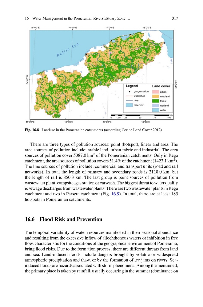
Fig. 16.8 Landuse in the Pomeranian catchments (according Corine Land Cover 2012)
There are three types of pollution sources: point (hotspot), linear and area. The
area sources of pollution include: arable land, urban fabric and industrial. The area
sources of pollution cover 5387.0 km
2 of the Pomeranian catchments. Only in Rega
catchment, the area sources of pollution covers 51.4% of the catchment (1423.1 km
2 ).
The line sources of pollution include: commercial and transport units (road and rail
networks). In total the length of primary and secondary roads is 2118.0 km, but
the length of rail is 850.3 km. The last group is point sources of pollution from
wastewater plant, campsite, gas station or carwash. The biggest threat to water quality
is sewage discharges from wastewater plants. There are two wastewater plants in Rega
catchment and two in Pars˛ eta catchment (Fig. 16.9). In total, there are at least 185
hotspots in Pomeranian catchments.
16.6 Flood Risk and Prevention
The temporal variability of water resources manifested in their seasonal abundance
and resulting from the excessive inflow of allochthonous waters or inhibition in free
flow, characteristic for the conditions of the geographical environment of Pomerania,
bring flood risks. Due to the formation process, there are different threats from land
and sea. Land-induced floods include dangers brought by volatile or widespread
atmospheric precipitation and thaw, or by the formation of ice jams on rivers. Seainduced floods are hazards associated with storm phenomena. Among the mentioned,
the primary place is taken by rainfall, usually occurring in the summer (dominance on
317
Fig. 16.8 Landuse in the Pomeranian catchments (according Corine Land Cover 2012)
There are three types of pollution sources: point (hotspot), linear and area. The
area sources of pollution include: arable land, urban fabric and industrial. The area
sources of pollution cover 5387.0 km
2 of the Pomeranian catchments. Only in Rega
catchment, the area sources of pollution covers 51.4% of the catchment (1423.1 km
2 ).
The line sources of pollution include: commercial and transport units (road and rail
networks). In total the length of primary and secondary roads is 2118.0 km, but
the length of rail is 850.3 km. The last group is point sources of pollution from
wastewater plant, campsite, gas station or carwash. The biggest threat to water quality
is sewage discharges from wastewater plants. There are two wastewater plants in Rega
catchment and two in Pars˛ eta catchment (Fig. 16.9). In total, there are at least 185
hotspots in Pomeranian catchments.
16.6 Flood Risk and Prevention
The temporal variability of water resources manifested in their seasonal abundance
and resulting from the excessive inflow of allochthonous waters or inhibition in free
flow, characteristic for the conditions of the geographical environment of Pomerania,
bring flood risks. Due to the formation process, there are different threats from land
and sea. Land-induced floods include dangers brought by volatile or widespread
atmospheric precipitation and thaw, or by the formation of ice jams on rivers. Seainduced floods are hazards associated with storm phenomena. Among the mentioned,
the primary place is taken by rainfall, usually occurring in the summer (dominance on