

256
M. Gor˛ aczko
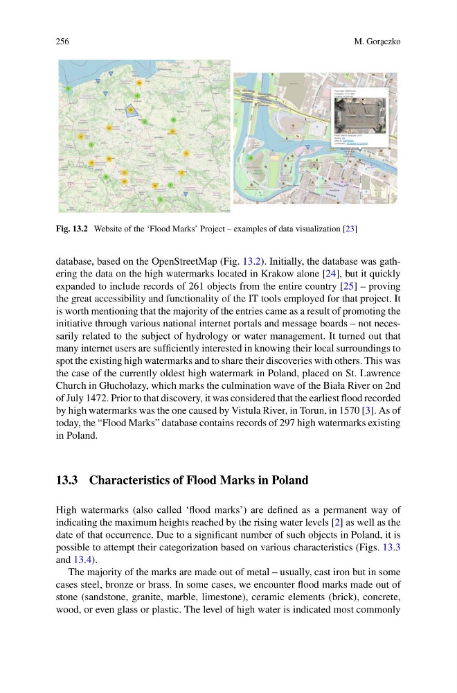
Fig. 13.2 Website of the ‘Flood Marks’ Project – examples of data visualization [23]
database, based on the OpenStreetMap (Fig. 13.2). Initially, the database was gathering the data on the high watermarks located in Krakow alone [24], but it quickly
expanded to include records of 261 objects from the entire country [25] – proving
the great accessibility and functionality of the IT tools employed for that project. It
is worth mentioning that the majority of the entries came as a result of promoting the
initiative through various national internet portals and message boards – not necessarily related to the subject of hydrology or water management. It turned out that
many internet users are sufficiently interested in knowing their local surroundings to
spot the existing high watermarks and to share their discoveries with others. This was
the case of the currently oldest high watermark in Poland, placed on St. Lawrence
Church in Głuchołazy, which marks the culmination wave of the Biała River on 2nd
of July 1472. Prior to that discovery, it was considered that the earliest flood recorded
by high watermarks was the one caused by Vistula River, in Torun, in 1570 [3]. As of
today, the “Flood Marks” database contains records of 297 high watermarks existing
in Poland.
13.3 Characteristics of Flood Marks in Poland
High watermarks (also called ‘flood marks’) are defined as a permanent way of
indicating the maximum heights reached by the rising water levels [2] as well as the
date of that occurrence. Due to a significant number of such objects in Poland, it is
possible to attempt their categorization based on various characteristics (Figs. 13.3
and 13.4).
The majority of the marks are made out of metal – usually, cast iron but in some
cases steel, bronze or brass. In some cases, we encounter flood marks made out of
stone (sandstone, granite, marble, limestone), ceramic elements (brick), concrete,
wood, or even glass or plastic. The level of high water is indicated most commonly
M. Gor˛ aczko
Fig. 13.2 Website of the ‘Flood Marks’ Project – examples of data visualization [23]
database, based on the OpenStreetMap (Fig. 13.2). Initially, the database was gathering the data on the high watermarks located in Krakow alone [24], but it quickly
expanded to include records of 261 objects from the entire country [25] – proving
the great accessibility and functionality of the IT tools employed for that project. It
is worth mentioning that the majority of the entries came as a result of promoting the
initiative through various national internet portals and message boards – not necessarily related to the subject of hydrology or water management. It turned out that
many internet users are sufficiently interested in knowing their local surroundings to
spot the existing high watermarks and to share their discoveries with others. This was
the case of the currently oldest high watermark in Poland, placed on St. Lawrence
Church in Głuchołazy, which marks the culmination wave of the Biała River on 2nd
of July 1472. Prior to that discovery, it was considered that the earliest flood recorded
by high watermarks was the one caused by Vistula River, in Torun, in 1570 [3]. As of
today, the “Flood Marks” database contains records of 297 high watermarks existing
in Poland.
13.3 Characteristics of Flood Marks in Poland
High watermarks (also called ‘flood marks’) are defined as a permanent way of
indicating the maximum heights reached by the rising water levels [2] as well as the
date of that occurrence. Due to a significant number of such objects in Poland, it is
possible to attempt their categorization based on various characteristics (Figs. 13.3
and 13.4).
The majority of the marks are made out of metal – usually, cast iron but in some
cases steel, bronze or brass. In some cases, we encounter flood marks made out of
stone (sandstone, granite, marble, limestone), ceramic elements (brick), concrete,
wood, or even glass or plastic. The level of high water is indicated most commonly