

298
17.5.4 Mining Wastes
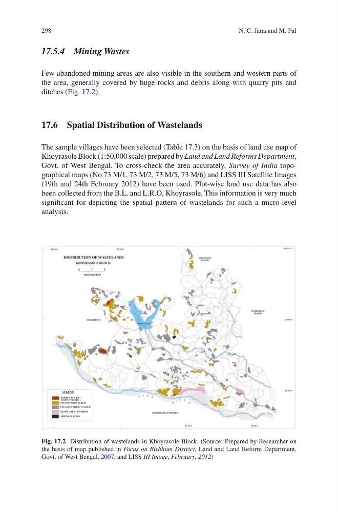
Few abandoned mining areas are also visible in the southern and western parts of
the area, generally covered by huge rocks and debris along with quarry pits and
ditches (Fig. 17.2).
17.6 Spatial Distribution of Wastelands
The sample villages have been selected (Table 17.3) on the basis of land use map of
Khoyrasole Block (1:50,000 scale) prepared by Land and Land Reforms Department,
Govt. of West Bengal. To cross-check the area accurately, Survey of India topographical maps (No 73 M/1, 73 M/2, 73 M/5, 73 M/6) and LISS III Satellite Images
(19th and 24th February 2012) have been used. Plot-wise land use data has also
been collected from the B.L. and L.R.O, Khoyrasole. This information is very much
significant for depicting the spatial pattern of wastelands for such a micro-level
analysis.
Fig. 17.2 Distribution of wastelands in Khoyrasole Block. (Source: Prepared by Researcher on
the basis of map published in Focus on Birbhum District, Land and Land Reform Department,
Govt. of West Bengal, 2007, and LISS III Image, February, 2012)
N. C. Jana and M. Pal
17.5.4 Mining Wastes
Few abandoned mining areas are also visible in the southern and western parts of
the area, generally covered by huge rocks and debris along with quarry pits and
ditches (Fig. 17.2).
17.6 Spatial Distribution of Wastelands
The sample villages have been selected (Table 17.3) on the basis of land use map of
Khoyrasole Block (1:50,000 scale) prepared by Land and Land Reforms Department,
Govt. of West Bengal. To cross-check the area accurately, Survey of India topographical maps (No 73 M/1, 73 M/2, 73 M/5, 73 M/6) and LISS III Satellite Images
(19th and 24th February 2012) have been used. Plot-wise land use data has also
been collected from the B.L. and L.R.O, Khoyrasole. This information is very much
significant for depicting the spatial pattern of wastelands for such a micro-level
analysis.
Fig. 17.2 Distribution of wastelands in Khoyrasole Block. (Source: Prepared by Researcher on
the basis of map published in Focus on Birbhum District, Land and Land Reform Department,
Govt. of West Bengal, 2007, and LISS III Image, February, 2012)
N. C. Jana and M. Pal