

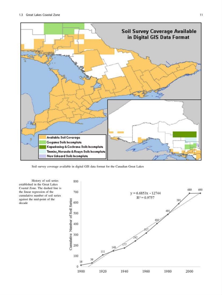
Fig. 1.6 Soil survey coverage available in digital GIS data format for the Canadian Great Lakes
Fig. 1.7 History of soil series
established in the Great Lakes
Coastal Zone. The dashed line is
the linear regression of the
cumulative number of soil series
against the mid-point of the
decade
1.3 Great Lakes Coastal Zone
11
Fig. 1.7 History of soil series
established in the Great Lakes
Coastal Zone. The dashed line is
the linear regression of the
cumulative number of soil series
against the mid-point of the
decade
1.3 Great Lakes Coastal Zone
11