

228
For each of the trips we take, we make sure to work closely with the local communities. We want to make sure the community knows we are there, why we are
there, and what we will be doing there. We also want to make sure that there is
exchange of knowledge. We can teach the communities a lot about how the system
works in a general sense in terms of geological and ecological processes. But the
local people are the experts in knowing how those general processes are manifesting
in their environment. They are the experts in knowing where the illegal fishing is
happening, they know where the coral bleaching is happening, and they know where
the mangrove forest was damaged by cyclones. We learn a lot from the local experts.
And both groups get excited when we can estimate changes in the mangrove forest
from space. One indigenous community, on the island of Calauit was pleased to see
that we estimated the location of mangroves that had died off following Typhoon
Yolanda in 2013. The typhoon crossed right over the island with Category 5 winds.
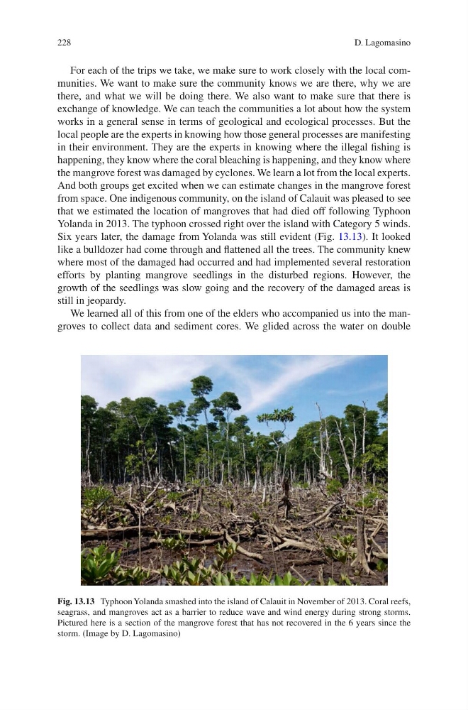
Six years later, the damage from Yolanda was still evident (Fig. 13.13). It looked
like a bulldozer had come through and flattened all the trees. The community knew
where most of the damaged had occurred and had implemented several restoration
efforts by planting mangrove seedlings in the disturbed regions. However, the
growth of the seedlings was slow going and the recovery of the damaged areas is
still in jeopardy.
We learned all of this from one of the elders who accompanied us into the mangroves to collect data and sediment cores. We glided across the water on double
Fig. 13.13 Typhoon Yolanda smashed into the island of Calauit in November of 2013. Coral reefs,
seagrass, and mangroves act as a barrier to reduce wave and wind energy during strong storms.
Pictured here is a section of the mangrove forest that has not recovered in the 6 years since the
storm. (Image by D. Lagomasino)
D. Lagomasino
For each of the trips we take, we make sure to work closely with the local communities. We want to make sure the community knows we are there, why we are
there, and what we will be doing there. We also want to make sure that there is
exchange of knowledge. We can teach the communities a lot about how the system
works in a general sense in terms of geological and ecological processes. But the
local people are the experts in knowing how those general processes are manifesting
in their environment. They are the experts in knowing where the illegal fishing is
happening, they know where the coral bleaching is happening, and they know where
the mangrove forest was damaged by cyclones. We learn a lot from the local experts.
And both groups get excited when we can estimate changes in the mangrove forest
from space. One indigenous community, on the island of Calauit was pleased to see
that we estimated the location of mangroves that had died off following Typhoon
Yolanda in 2013. The typhoon crossed right over the island with Category 5 winds.
Six years later, the damage from Yolanda was still evident (Fig. 13.13). It looked
like a bulldozer had come through and flattened all the trees. The community knew
where most of the damaged had occurred and had implemented several restoration
efforts by planting mangrove seedlings in the disturbed regions. However, the
growth of the seedlings was slow going and the recovery of the damaged areas is
still in jeopardy.
We learned all of this from one of the elders who accompanied us into the mangroves to collect data and sediment cores. We glided across the water on double
Fig. 13.13 Typhoon Yolanda smashed into the island of Calauit in November of 2013. Coral reefs,
seagrass, and mangroves act as a barrier to reduce wave and wind energy during strong storms.
Pictured here is a section of the mangrove forest that has not recovered in the 6 years since the
storm. (Image by D. Lagomasino)
D. Lagomasino