

229
outrigger boats built by the local shipbuilders (Fig. 13.10) to two sites in the mangrove forests, one badly damaged by the typhoon and another that had recovered. At
the first site we fully understood the extent of the damage; damage that we could
only estimate by remote sensing. Being there in person and collecting measurements and pictures will provide an additional level of accuracy to our landscape maps.
The second site was a beautiful mangrove forest. You could see some older
downed trees but, overall, the forest was intact. This is then when and where we
experienced why mangroves are so important to the local communities. While my
colleague and I were collecting sediment samples, the village elder was shoulder
deep in the mud collecting some samples of his own: mangrove clams. On return to
the village we had those clams steamed for lunch.
This was a meaningful trip, in particular because of the strong engagement with
local communities. In Sipalay we met with the mayor and the environmental
resources group; in Calauit we met with the village elders, and in Coron we met
with the organizations within the municipality that manage the local protected
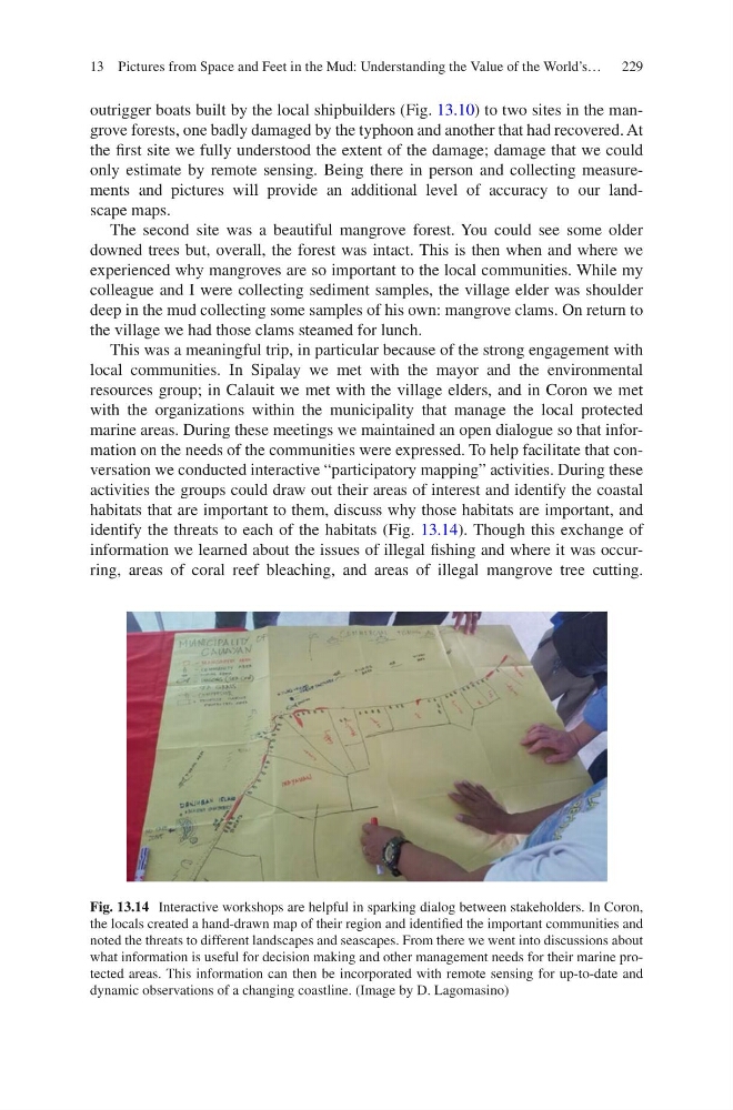
marine areas. During these meetings we maintained an open dialogue so that information on the needs of the communities were expressed. To help facilitate that conversation we conducted interactive “participatory mapping” activities. During these
activities the groups could draw out their areas of interest and identify the coastal
habitats that are important to them, discuss why those habitats are important, and
identify the threats to each of the habitats (Fig. 13.14). Though this exchange of
information we learned about the issues of illegal fishing and where it was occurring, areas of coral reef bleaching, and areas of illegal mangrove tree cutting.
Fig. 13.14 Interactive workshops are helpful in sparking dialog between stakeholders. In Coron,
the locals created a hand-drawn map of their region and identified the important communities and
noted the threats to different landscapes and seascapes. From there we went into discussions about
what information is useful for decision making and other management needs for their marine protected areas. This information can then be incorporated with remote sensing for up-to-date and
dynamic observations of a changing coastline. (Image by D. Lagomasino)
13 Pictures from Space and Feet in the Mud: Understanding the Value of the World’s…
outrigger boats built by the local shipbuilders (Fig. 13.10) to two sites in the mangrove forests, one badly damaged by the typhoon and another that had recovered. At
the first site we fully understood the extent of the damage; damage that we could
only estimate by remote sensing. Being there in person and collecting measurements and pictures will provide an additional level of accuracy to our landscape maps.
The second site was a beautiful mangrove forest. You could see some older
downed trees but, overall, the forest was intact. This is then when and where we
experienced why mangroves are so important to the local communities. While my
colleague and I were collecting sediment samples, the village elder was shoulder
deep in the mud collecting some samples of his own: mangrove clams. On return to
the village we had those clams steamed for lunch.
This was a meaningful trip, in particular because of the strong engagement with
local communities. In Sipalay we met with the mayor and the environmental
resources group; in Calauit we met with the village elders, and in Coron we met
with the organizations within the municipality that manage the local protected
marine areas. During these meetings we maintained an open dialogue so that information on the needs of the communities were expressed. To help facilitate that conversation we conducted interactive “participatory mapping” activities. During these
activities the groups could draw out their areas of interest and identify the coastal
habitats that are important to them, discuss why those habitats are important, and
identify the threats to each of the habitats (Fig. 13.14). Though this exchange of
information we learned about the issues of illegal fishing and where it was occurring, areas of coral reef bleaching, and areas of illegal mangrove tree cutting.
Fig. 13.14 Interactive workshops are helpful in sparking dialog between stakeholders. In Coron,
the locals created a hand-drawn map of their region and identified the important communities and
noted the threats to different landscapes and seascapes. From there we went into discussions about
what information is useful for decision making and other management needs for their marine protected areas. This information can then be incorporated with remote sensing for up-to-date and
dynamic observations of a changing coastline. (Image by D. Lagomasino)
13 Pictures from Space and Feet in the Mud: Understanding the Value of the World’s…