

227
with a separate GPS collect waypoints noting the depth-read from the live sonar
data and the bottom cover seen from the camera.
These observations gave us information at discrete locations or along narrow
transects directly under the path of the boat. To help us get a better idea of the extent
and distribution of the different habitats we also collected imagery from a drone that
was programmed to fly over the same areas. By programming and manually flying
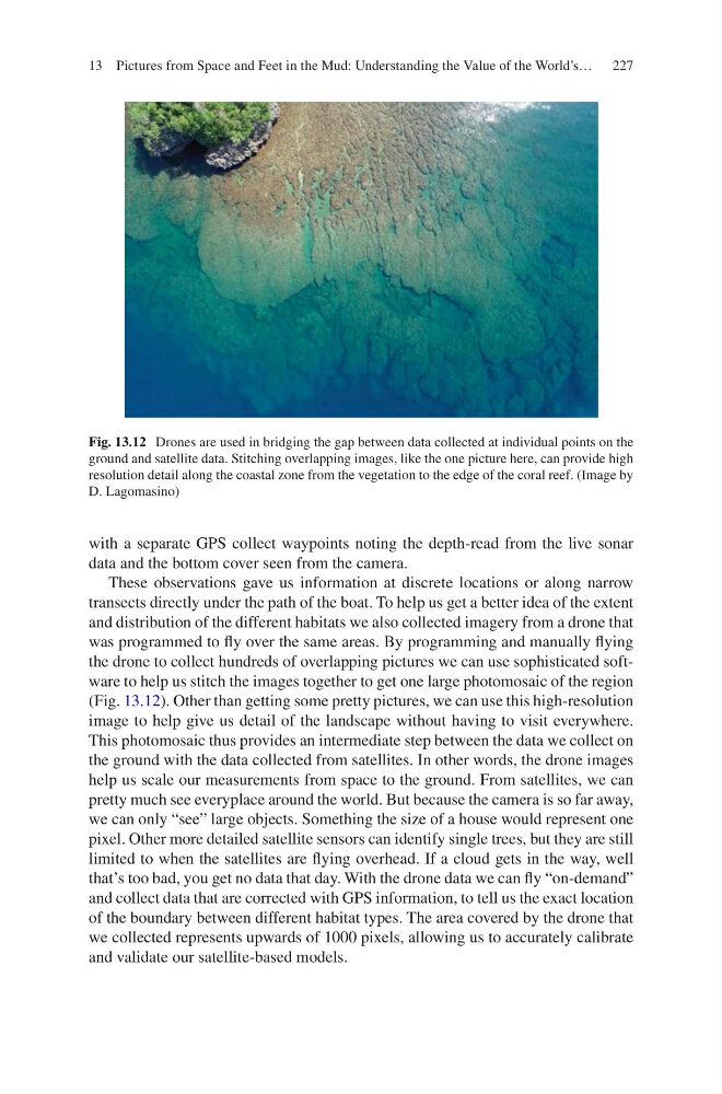
the drone to collect hundreds of overlapping pictures we can use sophisticated software to help us stitch the images together to get one large photomosaic of the region
(Fig. 13.12). Other than getting some pretty pictures, we can use this high- resolution
image to help give us detail of the landscape without having to visit everywhere.
This photomosaic thus provides an intermediate step between the data we collect on
the ground with the data collected from satellites. In other words, the drone images
help us scale our measurements from space to the ground. From satellites, we can
pretty much see everyplace around the world. But because the camera is so far away,
we can only “see” large objects. Something the size of a house would represent one
pixel. Other more detailed satellite sensors can identify single trees, but they are still
limited to when the satellites are flying overhead. If a cloud gets in the way, well
that’s too bad, you get no data that day. With the drone data we can fly “on-demand”
and collect data that are corrected with GPS information, to tell us the exact location
of the boundary between different habitat types. The area covered by the drone that
we collected represents upwards of 1000 pixels, allowing us to accurately calibrate
and validate our satellite-based models.
Fig. 13.12 Drones are used in bridging the gap between data collected at individual points on the
ground and satellite data. Stitching overlapping images, like the one picture here, can provide high
resolution detail along the coastal zone from the vegetation to the edge of the coral reef. (Image by
D. Lagomasino)
13 Pictures from Space and Feet in the Mud: Understanding the Value of the World’s…
with a separate GPS collect waypoints noting the depth-read from the live sonar
data and the bottom cover seen from the camera.
These observations gave us information at discrete locations or along narrow
transects directly under the path of the boat. To help us get a better idea of the extent
and distribution of the different habitats we also collected imagery from a drone that
was programmed to fly over the same areas. By programming and manually flying
the drone to collect hundreds of overlapping pictures we can use sophisticated software to help us stitch the images together to get one large photomosaic of the region
(Fig. 13.12). Other than getting some pretty pictures, we can use this high- resolution
image to help give us detail of the landscape without having to visit everywhere.
This photomosaic thus provides an intermediate step between the data we collect on
the ground with the data collected from satellites. In other words, the drone images
help us scale our measurements from space to the ground. From satellites, we can
pretty much see everyplace around the world. But because the camera is so far away,
we can only “see” large objects. Something the size of a house would represent one
pixel. Other more detailed satellite sensors can identify single trees, but they are still
limited to when the satellites are flying overhead. If a cloud gets in the way, well
that’s too bad, you get no data that day. With the drone data we can fly “on-demand”
and collect data that are corrected with GPS information, to tell us the exact location
of the boundary between different habitat types. The area covered by the drone that
we collected represents upwards of 1000 pixels, allowing us to accurately calibrate
and validate our satellite-based models.
Fig. 13.12 Drones are used in bridging the gap between data collected at individual points on the
ground and satellite data. Stitching overlapping images, like the one picture here, can provide high
resolution detail along the coastal zone from the vegetation to the edge of the coral reef. (Image by
D. Lagomasino)
13 Pictures from Space and Feet in the Mud: Understanding the Value of the World’s…