

146
Field Methods – Mapping, Stratigraphy and Coring
To describe the geologic framework, I construct maps and cross sections that show
the distribution of geologic layers, or strata, beneath the ground. Maps show the
areal distribution of geologic formations (airplane view of ground); geologic cross
sections (vertical slice through the ground akin to slicing open a layer cake) show
the strata, or layers, beneath the ground. As explained to me in introductory geology
class, the top of a Hostess Twinkie Cupcake is map view, and the sliced-in-two cross
sectional view exposes the marshmallow. Field geologists such as I commonly collect information on stratigraphy at localities where the formations are exposed, or
easily viewable, at the ground surface. We call these outcrops. Outcrops commonly
occur along streams and roadcuts, and in open-pit mines.
NC’s Coastal Plain is very flat (low relief), has few outcrops, and is commonly
covered with wetland deposits. In areas such as this, geologists may collect geologic
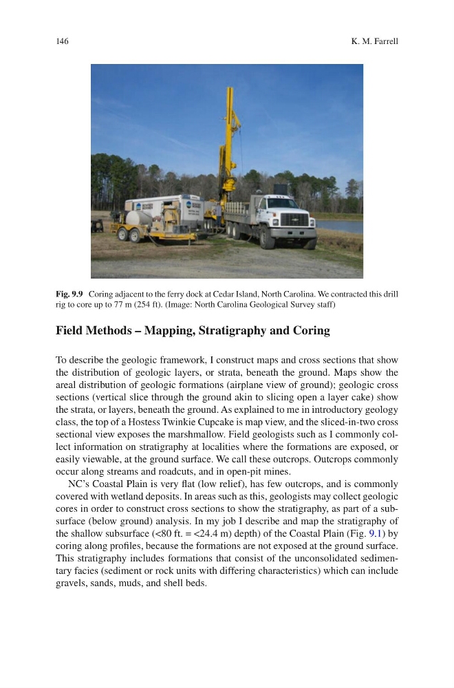
cores in order to construct cross sections to show the stratigraphy, as part of a subsurface (below ground) analysis. In my job I describe and map the stratigraphy of
the shallow subsurface (<80 ft. = <24.4 m) depth) of the Coastal Plain (Fig. 9.1) by
coring along profiles, because the formations are not exposed at the ground surface.
This stratigraphy includes formations that consist of the unconsolidated sedimentary facies (sediment or rock units with differing characteristics) which can include
gravels, sands, muds, and shell beds.
Fig. 9.9 Coring adjacent to the ferry dock at Cedar Island, North Carolina. We contracted this drill
rig to core up to 77 m (254 ft). (Image: North Carolina Geological Survey staff)
K. M. Farrell
Field Methods – Mapping, Stratigraphy and Coring
To describe the geologic framework, I construct maps and cross sections that show
the distribution of geologic layers, or strata, beneath the ground. Maps show the
areal distribution of geologic formations (airplane view of ground); geologic cross
sections (vertical slice through the ground akin to slicing open a layer cake) show
the strata, or layers, beneath the ground. As explained to me in introductory geology
class, the top of a Hostess Twinkie Cupcake is map view, and the sliced-in-two cross
sectional view exposes the marshmallow. Field geologists such as I commonly collect information on stratigraphy at localities where the formations are exposed, or
easily viewable, at the ground surface. We call these outcrops. Outcrops commonly
occur along streams and roadcuts, and in open-pit mines.
NC’s Coastal Plain is very flat (low relief), has few outcrops, and is commonly
covered with wetland deposits. In areas such as this, geologists may collect geologic
cores in order to construct cross sections to show the stratigraphy, as part of a subsurface (below ground) analysis. In my job I describe and map the stratigraphy of
the shallow subsurface (<80 ft. = <24.4 m) depth) of the Coastal Plain (Fig. 9.1) by
coring along profiles, because the formations are not exposed at the ground surface.
This stratigraphy includes formations that consist of the unconsolidated sedimentary facies (sediment or rock units with differing characteristics) which can include
gravels, sands, muds, and shell beds.
Fig. 9.9 Coring adjacent to the ferry dock at Cedar Island, North Carolina. We contracted this drill
rig to core up to 77 m (254 ft). (Image: North Carolina Geological Survey staff)
K. M. Farrell