

147
To obtain geologic core samples, my current field work uses a small drill rig,
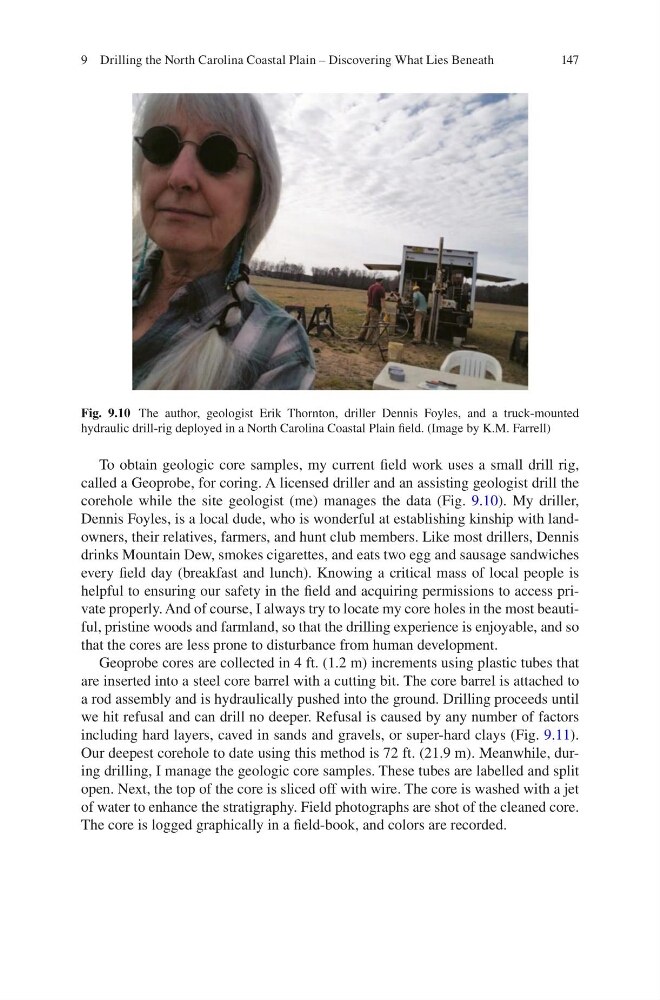
called a Geoprobe, for coring. A licensed driller and an assisting geologist drill the
corehole while the site geologist (me) manages the data (Fig. 9.10). My driller,
Dennis Foyles, is a local dude, who is wonderful at establishing kinship with landowners, their relatives, farmers, and hunt club members. Like most drillers, Dennis
drinks Mountain Dew, smokes cigarettes, and eats two egg and sausage sandwiches
every field day (breakfast and lunch). Knowing a critical mass of local people is
helpful to ensuring our safety in the field and acquiring permissions to access private properly. And of course, I always try to locate my core holes in the most beautiful, pristine woods and farmland, so that the drilling experience is enjoyable, and so
that the cores are less prone to disturbance from human development.
Geoprobe cores are collected in 4 ft. (1.2 m) increments using plastic tubes that
are inserted into a steel core barrel with a cutting bit. The core barrel is attached to
a rod assembly and is hydraulically pushed into the ground. Drilling proceeds until
we hit refusal and can drill no deeper. Refusal is caused by any number of factors
including hard layers, caved in sands and gravels, or super-hard clays (Fig. 9.11).
Our deepest corehole to date using this method is 72 ft. (21.9 m). Meanwhile, during drilling, I manage the geologic core samples. These tubes are labelled and split
open. Next, the top of the core is sliced off with wire. The core is washed with a jet
of water to enhance the stratigraphy. Field photographs are shot of the cleaned core.
The core is logged graphically in a field-book, and colors are recorded.
Fig. 9.10 The author, geologist Erik Thornton, driller Dennis Foyles, and a truck-mounted
hydraulic drill-rig deployed in a North Carolina Coastal Plain field. (Image by K.M. Farrell)
9 Drilling the North Carolina Coastal Plain – Discovering What Lies Beneath
To obtain geologic core samples, my current field work uses a small drill rig,
called a Geoprobe, for coring. A licensed driller and an assisting geologist drill the
corehole while the site geologist (me) manages the data (Fig. 9.10). My driller,
Dennis Foyles, is a local dude, who is wonderful at establishing kinship with landowners, their relatives, farmers, and hunt club members. Like most drillers, Dennis
drinks Mountain Dew, smokes cigarettes, and eats two egg and sausage sandwiches
every field day (breakfast and lunch). Knowing a critical mass of local people is
helpful to ensuring our safety in the field and acquiring permissions to access private properly. And of course, I always try to locate my core holes in the most beautiful, pristine woods and farmland, so that the drilling experience is enjoyable, and so
that the cores are less prone to disturbance from human development.
Geoprobe cores are collected in 4 ft. (1.2 m) increments using plastic tubes that
are inserted into a steel core barrel with a cutting bit. The core barrel is attached to
a rod assembly and is hydraulically pushed into the ground. Drilling proceeds until
we hit refusal and can drill no deeper. Refusal is caused by any number of factors
including hard layers, caved in sands and gravels, or super-hard clays (Fig. 9.11).
Our deepest corehole to date using this method is 72 ft. (21.9 m). Meanwhile, during drilling, I manage the geologic core samples. These tubes are labelled and split
open. Next, the top of the core is sliced off with wire. The core is washed with a jet
of water to enhance the stratigraphy. Field photographs are shot of the cleaned core.
The core is logged graphically in a field-book, and colors are recorded.
Fig. 9.10 The author, geologist Erik Thornton, driller Dennis Foyles, and a truck-mounted
hydraulic drill-rig deployed in a North Carolina Coastal Plain field. (Image by K.M. Farrell)
9 Drilling the North Carolina Coastal Plain – Discovering What Lies Beneath