

The Taieri Plain is another example of an alluvial basin
close to the base level. Lake Waihola at the southern end is
at sea level and controls the base level of the plain and, thus,
the sedimentation regime. The Taieri River, and the smaller
Silverstream, flow across the basin, through Lake Waihola,
and then drain to the Pacific Ocean via an antecedent gorge.
Where there is no appreciable down cutting by streams and
rivers, into the surface of the plain, the soil materials are
dominantly constructed by accumulated flood sedimentation
(Fig. 14.6). However, in the higher reaches of the Silverstream the alluvial sediment has been weakly eroded. It is
interpreted to be a relict lake floor, possibly a former
extension of Lake Waihola. It is possible that the main
erosion event occurred following a lowering of base level,
by either tectonic uplift or lowering of sea level, with consequent dewatering of the former lake.
In the town of Mosgiel, sediment from the Silverstream
enters in the northeast corner and splays out as a series of
gentle fine sandy loam ridges with a channel along the crest
in-filled with sand or sandy loam. The channels have the
form of a distributary pattern because they distribute drainage of water outward to the former lake. The pattern is that
of a delta that remains from pre-human times. There is a
range of sedimentary features associated with flood plain
rivers, such as those of the Taieri River. First, is the substantial natural levee of the river that meanders across the
plain. Floods have frequently over-topped its bank and
formed a large-scale levee/back swamp system. Second, is a
fingered array of sediment called a crevasse splay. It is a
point where the river levee was at one time breached and
sediment rapidly spewed out and down the levee slope. The
sediments are often wide-ranging in texture and with gravels
indicating a disordered event. Third, below the crevasse
splay feature (though not necessarily related) are two characteristics typical of levee systems: (a) a texture gradient
from relatively coarse texture near the crest (where water
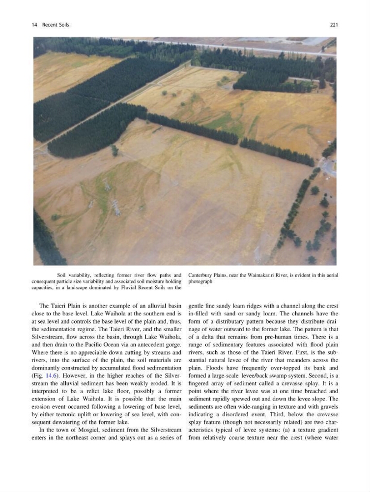
Fig. 14.5 Soil variability, reflecting former river flow paths and
consequent particle size variability and associated soil moisture holding
capacities, in a landscape dominated by Fluvial Recent Soils on the
Canterbury Plains, near the Waimakariri River, is evident in this aerial
photograph
14 Recent Soils
221
close to the base level. Lake Waihola at the southern end is
at sea level and controls the base level of the plain and, thus,
the sedimentation regime. The Taieri River, and the smaller
Silverstream, flow across the basin, through Lake Waihola,
and then drain to the Pacific Ocean via an antecedent gorge.
Where there is no appreciable down cutting by streams and
rivers, into the surface of the plain, the soil materials are
dominantly constructed by accumulated flood sedimentation
(Fig. 14.6). However, in the higher reaches of the Silverstream the alluvial sediment has been weakly eroded. It is
interpreted to be a relict lake floor, possibly a former
extension of Lake Waihola. It is possible that the main
erosion event occurred following a lowering of base level,
by either tectonic uplift or lowering of sea level, with consequent dewatering of the former lake.
In the town of Mosgiel, sediment from the Silverstream
enters in the northeast corner and splays out as a series of
gentle fine sandy loam ridges with a channel along the crest
in-filled with sand or sandy loam. The channels have the
form of a distributary pattern because they distribute drainage of water outward to the former lake. The pattern is that
of a delta that remains from pre-human times. There is a
range of sedimentary features associated with flood plain
rivers, such as those of the Taieri River. First, is the substantial natural levee of the river that meanders across the
plain. Floods have frequently over-topped its bank and
formed a large-scale levee/back swamp system. Second, is a
fingered array of sediment called a crevasse splay. It is a
point where the river levee was at one time breached and
sediment rapidly spewed out and down the levee slope. The
sediments are often wide-ranging in texture and with gravels
indicating a disordered event. Third, below the crevasse
splay feature (though not necessarily related) are two characteristics typical of levee systems: (a) a texture gradient
from relatively coarse texture near the crest (where water
Fig. 14.5 Soil variability, reflecting former river flow paths and
consequent particle size variability and associated soil moisture holding
capacities, in a landscape dominated by Fluvial Recent Soils on the
Canterbury Plains, near the Waimakariri River, is evident in this aerial
photograph
14 Recent Soils
221