

Seismometers and seismological networks 411
Time after earthquake (s)
2400
2350
2300
2250
2200
2150
2100
P ′
410 P ′
P ′
660 P ′
64°
66°
68°
70°
Distance
17 October 1990
Peru–Brazil
P ′P ′
Fig. 6.6-19 Records from the short-period
seismometers of California regional
networks for an Oct. 17, 1990, earthquake
in South America. The data reveal distinct
reflections off the sharp 410 km and
660 km mantle discontinuities. The ability
to examine large amount of data over a
small geographical region greatly increases
the resolution of earth structure. (Benz and
Vidale, 1993. Reproduced with permission
from Nature.)
235
240
245
250
255
260
265
270
275
280
285
290
50
45
40
35
30
25
Longitude
Latitude
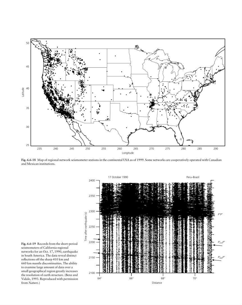
Fig. 6.6-18 Map of regional network seismometer stations in the continental USA as of 1999. Some networks are cooperatively operated with Canadian
and Mexican institutions.
Time after earthquake (s)
2400
2350
2300
2250
2200
2150
2100
P ′
410 P ′
P ′
660 P ′
64°
66°
68°
70°
Distance
17 October 1990
Peru–Brazil
P ′P ′
Fig. 6.6-19 Records from the short-period
seismometers of California regional
networks for an Oct. 17, 1990, earthquake
in South America. The data reveal distinct
reflections off the sharp 410 km and
660 km mantle discontinuities. The ability
to examine large amount of data over a
small geographical region greatly increases
the resolution of earth structure. (Benz and
Vidale, 1993. Reproduced with permission
from Nature.)
235
240
245
250
255
260
265
270
275
280
285
290
50
45
40
35
30
25
Longitude
Latitude
Fig. 6.6-18 Map of regional network seismometer stations in the continental USA as of 1999. Some networks are cooperatively operated with Canadian
and Mexican institutions.