

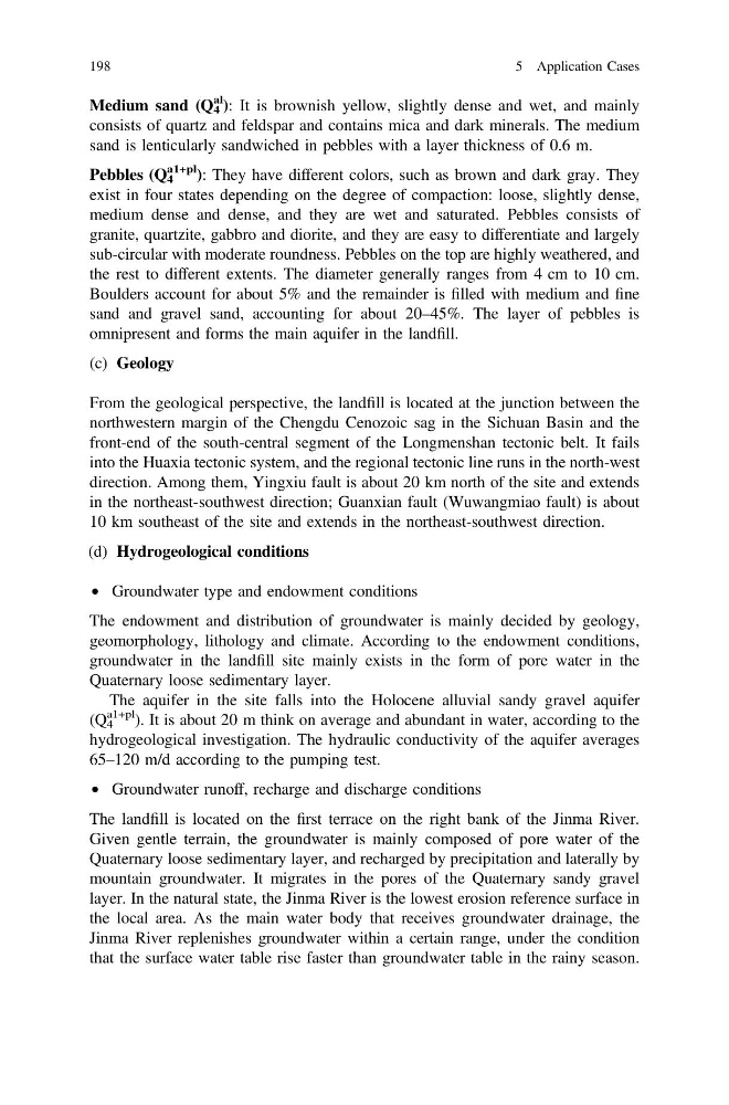
Medium sand (Q 4
al ): It is brownish yellow, slightly dense and wet, and mainly
consists of quartz and feldspar and contains mica and dark minerals. The medium
sand is lenticularly sandwiched in pebbles with a layer thickness of 0.6 m.
Pebbles (Q 4
a1+pl ): They have different colors, such as brown and dark gray. They
exist in four states depending on the degree of compaction: loose, slightly dense,
medium dense and dense, and they are wet and saturated. Pebbles consists of
granite, quartzite, gabbro and diorite, and they are easy to differentiate and largely
sub-circular with moderate roundness. Pebbles on the top are highly weathered, and
the rest to different extents. The diameter generally ranges from 4 cm to 10 cm.
Boulders account for about 5% and the remainder is filled with medium and fine
sand and gravel sand, accounting for about 20–45%. The layer of pebbles is
omnipresent and forms the main aquifer in the landfill.
(c) Geology
From the geological perspective, the landfill is located at the junction between the
northwestern margin of the Chengdu Cenozoic sag in the Sichuan Basin and the
front-end of the south-central segment of the Longmenshan tectonic belt. It fails
into the Huaxia tectonic system, and the regional tectonic line runs in the north-west
direction. Among them, Yingxiu fault is about 20 km north of the site and extends
in the northeast-southwest direction; Guanxian fault (Wuwangmiao fault) is about
10 km southeast of the site and extends in the northeast-southwest direction.
(d) Hydrogeological conditions
• Groundwater type and endowment conditions
The endowment and distribution of groundwater is mainly decided by geology,
geomorphology, lithology and climate. According to the endowment conditions,
groundwater in the landfill site mainly exists in the form of pore water in the
Quaternary loose sedimentary layer.
The aquifer in the site falls into the Holocene alluvial sandy gravel aquifer
(Q 4
a1+pl ). It is about 20 m think on average and abundant in water, according to the
hydrogeological investigation. The hydraulic conductivity of the aquifer averages
65–120 m/d according to the pumping test.
• Groundwater runoff, recharge and discharge conditions
The landfill is located on the first terrace on the right bank of the Jinma River.
Given gentle terrain, the groundwater is mainly composed of pore water of the
Quaternary loose sedimentary layer, and recharged by precipitation and laterally by
mountain groundwater. It migrates in the pores of the Quaternary sandy gravel
layer. In the natural state, the Jinma River is the lowest erosion reference surface in
the local area. As the main water body that receives groundwater drainage, the
Jinma River replenishes groundwater within a certain range, under the condition
that the surface water table rise faster than groundwater table in the rainy season.
198
5 Application Cases
al ): It is brownish yellow, slightly dense and wet, and mainly
consists of quartz and feldspar and contains mica and dark minerals. The medium
sand is lenticularly sandwiched in pebbles with a layer thickness of 0.6 m.
Pebbles (Q 4
a1+pl ): They have different colors, such as brown and dark gray. They
exist in four states depending on the degree of compaction: loose, slightly dense,
medium dense and dense, and they are wet and saturated. Pebbles consists of
granite, quartzite, gabbro and diorite, and they are easy to differentiate and largely
sub-circular with moderate roundness. Pebbles on the top are highly weathered, and
the rest to different extents. The diameter generally ranges from 4 cm to 10 cm.
Boulders account for about 5% and the remainder is filled with medium and fine
sand and gravel sand, accounting for about 20–45%. The layer of pebbles is
omnipresent and forms the main aquifer in the landfill.
(c) Geology
From the geological perspective, the landfill is located at the junction between the
northwestern margin of the Chengdu Cenozoic sag in the Sichuan Basin and the
front-end of the south-central segment of the Longmenshan tectonic belt. It fails
into the Huaxia tectonic system, and the regional tectonic line runs in the north-west
direction. Among them, Yingxiu fault is about 20 km north of the site and extends
in the northeast-southwest direction; Guanxian fault (Wuwangmiao fault) is about
10 km southeast of the site and extends in the northeast-southwest direction.
(d) Hydrogeological conditions
• Groundwater type and endowment conditions
The endowment and distribution of groundwater is mainly decided by geology,
geomorphology, lithology and climate. According to the endowment conditions,
groundwater in the landfill site mainly exists in the form of pore water in the
Quaternary loose sedimentary layer.
The aquifer in the site falls into the Holocene alluvial sandy gravel aquifer
(Q 4
a1+pl ). It is about 20 m think on average and abundant in water, according to the
hydrogeological investigation. The hydraulic conductivity of the aquifer averages
65–120 m/d according to the pumping test.
• Groundwater runoff, recharge and discharge conditions
The landfill is located on the first terrace on the right bank of the Jinma River.
Given gentle terrain, the groundwater is mainly composed of pore water of the
Quaternary loose sedimentary layer, and recharged by precipitation and laterally by
mountain groundwater. It migrates in the pores of the Quaternary sandy gravel
layer. In the natural state, the Jinma River is the lowest erosion reference surface in
the local area. As the main water body that receives groundwater drainage, the
Jinma River replenishes groundwater within a certain range, under the condition
that the surface water table rise faster than groundwater table in the rainy season.
198
5 Application Cases