

and 100 years is considered. The discharges of the different return periods are
calculated.
Processing of Hydraulic Modeling
Hydraulic modeling is used to obtain floodplain and flood hazard maps for the
Koraiyar basin in Tiruchirappalli city. The flood portion is defined through
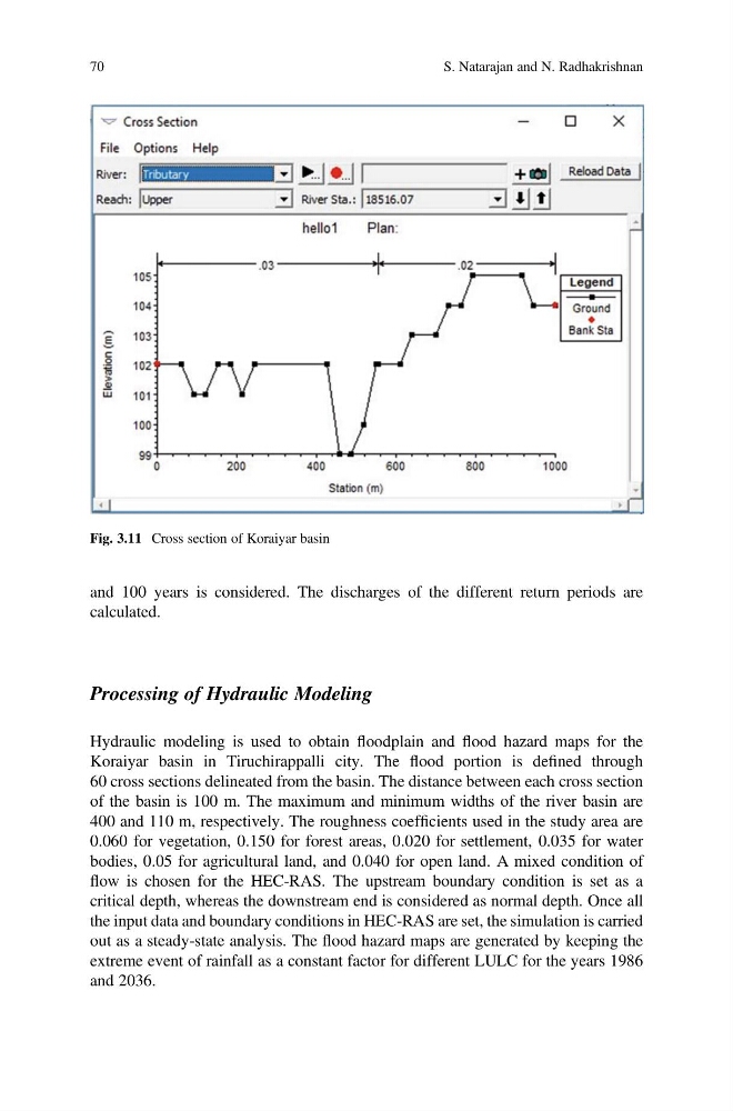
60 cross sections delineated from the basin. The distance between each cross section
of the basin is 100 m. The maximum and minimum widths of the river basin are
400 and 110 m, respectively. The roughness coefficients used in the study area are
0.060 for vegetation, 0.150 for forest areas, 0.020 for settlement, 0.035 for water
bodies, 0.05 for agricultural land, and 0.040 for open land. A mixed condition of
flow is chosen for the HEC-RAS. The upstream boundary condition is set as a
critical depth, whereas the downstream end is considered as normal depth. Once all
the input data and boundary conditions in HEC-RAS are set, the simulation is carried
out as a steady-state analysis. The flood hazard maps are generated by keeping the
extreme event of rainfall as a constant factor for different LULC for the years 1986
and 2036.
Fig. 3.11 Cross section of Koraiyar basin
70
S. Natarajan and N. Radhakrishnan
calculated.
Processing of Hydraulic Modeling
Hydraulic modeling is used to obtain floodplain and flood hazard maps for the
Koraiyar basin in Tiruchirappalli city. The flood portion is defined through
60 cross sections delineated from the basin. The distance between each cross section
of the basin is 100 m. The maximum and minimum widths of the river basin are
400 and 110 m, respectively. The roughness coefficients used in the study area are
0.060 for vegetation, 0.150 for forest areas, 0.020 for settlement, 0.035 for water
bodies, 0.05 for agricultural land, and 0.040 for open land. A mixed condition of
flow is chosen for the HEC-RAS. The upstream boundary condition is set as a
critical depth, whereas the downstream end is considered as normal depth. Once all
the input data and boundary conditions in HEC-RAS are set, the simulation is carried
out as a steady-state analysis. The flood hazard maps are generated by keeping the
extreme event of rainfall as a constant factor for different LULC for the years 1986
and 2036.
Fig. 3.11 Cross section of Koraiyar basin
70
S. Natarajan and N. Radhakrishnan