

(1899). The latter was abandoned in 1979, when the so-called Grand Gabarit canal
(4.8 m draught) cut across the lower Bassée from La Grande Bosse to Montereau
(Fig. 6).
In the 1970s, the hydrological dynamics of the Bassée were also impacted by the
operation of two large reservoirs (Aube and Seine Reservoirs; see Fig. 1): the low
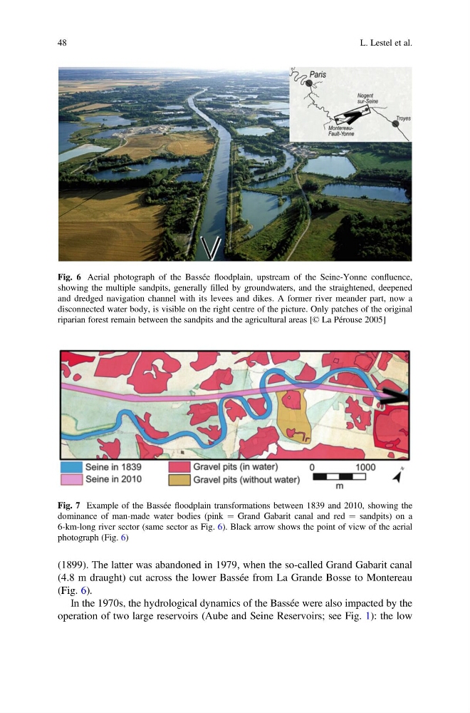
Fig. 7 Example of the Bassée floodplain transformations between 1839 and 2010, showing the
dominance of man-made water bodies (pink ¼ Grand Gabarit canal and red ¼ sandpits) on a
6-km-long river sector (same sector as Fig. 6). Black arrow shows the point of view of the aerial
photograph (Fig. 6)
Fig. 6 Aerial photograph of the Bassée floodplain, upstream of the Seine-Yonne confluence,
showing the multiple sandpits, generally filled by groundwaters, and the straightened, deepened
and dredged navigation channel with its levees and dikes. A former river meander part, now a
disconnected water body, is visible on the right centre of the picture. Only patches of the original
riparian forest remain between the sandpits and the agricultural areas [© La Pérouse 2005]
48
L. Lestel et al.
(4.8 m draught) cut across the lower Bassée from La Grande Bosse to Montereau
(Fig. 6).
In the 1970s, the hydrological dynamics of the Bassée were also impacted by the
operation of two large reservoirs (Aube and Seine Reservoirs; see Fig. 1): the low
Fig. 7 Example of the Bassée floodplain transformations between 1839 and 2010, showing the
dominance of man-made water bodies (pink ¼ Grand Gabarit canal and red ¼ sandpits) on a
6-km-long river sector (same sector as Fig. 6). Black arrow shows the point of view of the aerial
photograph (Fig. 6)
Fig. 6 Aerial photograph of the Bassée floodplain, upstream of the Seine-Yonne confluence,
showing the multiple sandpits, generally filled by groundwaters, and the straightened, deepened
and dredged navigation channel with its levees and dikes. A former river meander part, now a
disconnected water body, is visible on the right centre of the picture. Only patches of the original
riparian forest remain between the sandpits and the agricultural areas [© La Pérouse 2005]
48
L. Lestel et al.