

from reservoirs. This estimate is based on a
model calculation of 400 fruit trees per ha and
water consumption of 20 m
3 per tree and irrigation season (typical figures, farm consultant
personal communication) on the approx. 50 ha of
farmland (study site). As a consequence of irrigation, however, the reservoirs would limit their
benefit for other ecosystem services such as
wildlife habitat, microclimate regulation, recreational use or groundwater recharge. The calculation also illustrates how dependent agriculture
in this area is on external water supplies.
4.3 Long-Term Weather Changes
Long-term average rainfall for Gibraleón (1901–
2015) being 533 (151) mm/year, corresponds
quite well with the recent record for 2011–2016
which is 551 (96) mm/year but is well below the
previous decade’s (2000–2010) which had more
rain—675 (164) mm/year. Whether statistically
significant or not, this might still have misled
project developers. However, long-term average
annual rainfall for Gibraleón is still slightly
below current conditions, which suggest that
dryer years may still come if the system is
returning to its long-term average. This means
that plenty of years with below-average rainfall
can be expected for Gibraleón, without taking
into account climate change projections.
4.4 Merits and Demerits of the Model
While some large-scale permaculture-inspired
projects start on non-productive land without
the need to produce commodities, an existing
farm must remain productive and financially
viable during any conversion process. In this
context, the authors advocate for closer collaboration between producers interested in
‘permaculture farming’ and academic institutions as well as local authorities, given that
many such conversions have strong experimental elements that may benefit from thorough interdisciplinary planning as well as
systematic and ongoing monitoring. With this
in mind, a simple WH computer modelling
technique may help to improve planning and
monitoring. The strengths and weaknesses of
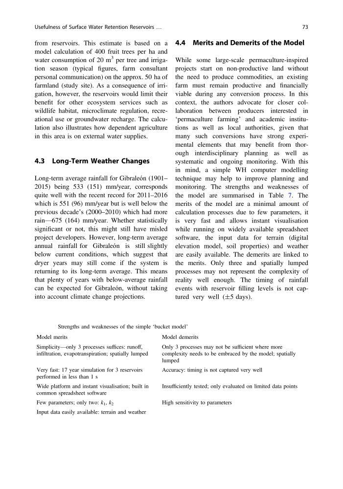
the model are summarised in Table 7. The
merits of the model are a minimal amount of
calculation processes due to few parameters, it
is very fast and allows instant visualisation
while running on widely available spreadsheet
software, the input data for terrain (digital
elevation model, soil properties) and weather
are easily available. The demerits are linked to
the merits. Only three and spatially lumped
processes may not represent the complexity of
reality well enough. The timing of rainfall
events with reservoir filling levels is not captured very well (±5 days).
Table 7 Strengths and weaknesses of the simple ‘bucket model’
Model merits
Model demerits
Simplicity—only 3 processes suffices: runoff,
infiltration, evapotranspiration; spatially lumped
Only 3 processes may not be sufficient where more
complexity needs to be embraced by the model; spatially
lumped
Very fast: 17 year simulation for 3 reservoirs
performed in less than 1 s
Accuracy: timing is not captured very well
Wide platform and instant visualisation; built in
common spreadsheet software
Insufficiently tested; only evaluated on limited data points
Few parameters; only two: k 1 , k 2
High sensitivity to parameters
Input data easily available: terrain and weather
Usefulness of Surface Water Retention Reservoirs …
73
model calculation of 400 fruit trees per ha and
water consumption of 20 m
3 per tree and irrigation season (typical figures, farm consultant
personal communication) on the approx. 50 ha of
farmland (study site). As a consequence of irrigation, however, the reservoirs would limit their
benefit for other ecosystem services such as
wildlife habitat, microclimate regulation, recreational use or groundwater recharge. The calculation also illustrates how dependent agriculture
in this area is on external water supplies.
4.3 Long-Term Weather Changes
Long-term average rainfall for Gibraleón (1901–
2015) being 533 (151) mm/year, corresponds
quite well with the recent record for 2011–2016
which is 551 (96) mm/year but is well below the
previous decade’s (2000–2010) which had more
rain—675 (164) mm/year. Whether statistically
significant or not, this might still have misled
project developers. However, long-term average
annual rainfall for Gibraleón is still slightly
below current conditions, which suggest that
dryer years may still come if the system is
returning to its long-term average. This means
that plenty of years with below-average rainfall
can be expected for Gibraleón, without taking
into account climate change projections.
4.4 Merits and Demerits of the Model
While some large-scale permaculture-inspired
projects start on non-productive land without
the need to produce commodities, an existing
farm must remain productive and financially
viable during any conversion process. In this
context, the authors advocate for closer collaboration between producers interested in
‘permaculture farming’ and academic institutions as well as local authorities, given that
many such conversions have strong experimental elements that may benefit from thorough interdisciplinary planning as well as
systematic and ongoing monitoring. With this
in mind, a simple WH computer modelling
technique may help to improve planning and
monitoring. The strengths and weaknesses of
the model are summarised in Table 7. The
merits of the model are a minimal amount of
calculation processes due to few parameters, it
is very fast and allows instant visualisation
while running on widely available spreadsheet
software, the input data for terrain (digital
elevation model, soil properties) and weather
are easily available. The demerits are linked to
the merits. Only three and spatially lumped
processes may not represent the complexity of
reality well enough. The timing of rainfall
events with reservoir filling levels is not captured very well (±5 days).
Table 7 Strengths and weaknesses of the simple ‘bucket model’
Model merits
Model demerits
Simplicity—only 3 processes suffices: runoff,
infiltration, evapotranspiration; spatially lumped
Only 3 processes may not be sufficient where more
complexity needs to be embraced by the model; spatially
lumped
Very fast: 17 year simulation for 3 reservoirs
performed in less than 1 s
Accuracy: timing is not captured very well
Wide platform and instant visualisation; built in
common spreadsheet software
Insufficiently tested; only evaluated on limited data points
Few parameters; only two: k 1 , k 2
High sensitivity to parameters
Input data easily available: terrain and weather
Usefulness of Surface Water Retention Reservoirs …
73