

2.3.3 Characteristics of the Carrizal
Aquifer
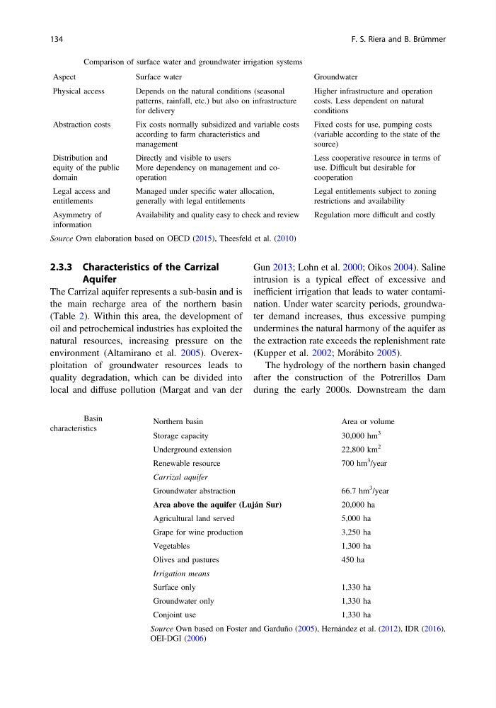
The Carrizal aquifer represents a sub-basin and is
the main recharge area of the northern basin
(Table 2). Within this area, the development of
oil and petrochemical industries has exploited the
natural resources, increasing pressure on the
environment (Altamirano et al. 2005). Overexploitation of groundwater resources leads to
quality degradation, which can be divided into
local and diffuse pollution (Margat and van der
Gun 2013; Lohn et al. 2000; Oikos 2004). Saline
intrusion is a typical effect of excessive and
inefficient irrigation that leads to water contamination. Under water scarcity periods, groundwater demand increases, thus excessive pumping
undermines the natural harmony of the aquifer as
the extraction rate exceeds the replenishment rate
(Kupper et al. 2002; Morábito 2005).
The hydrology of the northern basin changed
after the construction of the Potrerillos Dam
during the early 2000s. Downstream the dam
Table 1 Comparison of surface water and groundwater irrigation systems
Aspect
Surface water
Groundwater
Physical access
Depends on the natural conditions (seasonal
patterns, rainfall, etc.) but also on infrastructure
for delivery
Higher infrastructure and operation
costs. Less dependent on natural
conditions
Abstraction costs
Fix costs normally subsidized and variable costs
according to farm characteristics and
management
Fixed costs for use, pumping costs
(variable according to the state of the
source)
Distribution and
equity of the public
domain
Directly and visible to users
More dependency on management and cooperation
Less cooperative resource in terms of
use. Difficult but desirable for
cooperation
Legal access and
entitlements
Managed under specific water allocation,
generally with legal entitlements
Legal entitlements subject to zoning
restrictions and availability
Asymmetry of
information
Availability and quality easy to check and review
Regulation more difficult and costly
Source Own elaboration based on OECD (2015), Theesfeld et al. (2010)
Table 2 Basin
characteristics
Northern basin
Area or volume
Storage capacity
30,000 hm
3
Underground extension
22,800 km
2
Renewable resource
700 hm
3
/year
Carrizal aquifer
Groundwater abstraction
66.7 hm
3
/year
Area above the aquifer (Luján Sur)
20,000 ha
Agricultural land served
5,000 ha
Grape for wine production
3,250 ha
Vegetables
1,300 ha
Olives and pastures
450 ha
Irrigation means
Surface only
1,330 ha
Groundwater only
1,330 ha
Conjoint use
1,330 ha
Source Own based on Foster and Garduño (2005), Hernández et al. (2012), IDR (2016),
OEI-DGI (2006)
134
F. S. Riera and B. Brümmer
Aquifer
The Carrizal aquifer represents a sub-basin and is
the main recharge area of the northern basin
(Table 2). Within this area, the development of
oil and petrochemical industries has exploited the
natural resources, increasing pressure on the
environment (Altamirano et al. 2005). Overexploitation of groundwater resources leads to
quality degradation, which can be divided into
local and diffuse pollution (Margat and van der
Gun 2013; Lohn et al. 2000; Oikos 2004). Saline
intrusion is a typical effect of excessive and
inefficient irrigation that leads to water contamination. Under water scarcity periods, groundwater demand increases, thus excessive pumping
undermines the natural harmony of the aquifer as
the extraction rate exceeds the replenishment rate
(Kupper et al. 2002; Morábito 2005).
The hydrology of the northern basin changed
after the construction of the Potrerillos Dam
during the early 2000s. Downstream the dam
Table 1 Comparison of surface water and groundwater irrigation systems
Aspect
Surface water
Groundwater
Physical access
Depends on the natural conditions (seasonal
patterns, rainfall, etc.) but also on infrastructure
for delivery
Higher infrastructure and operation
costs. Less dependent on natural
conditions
Abstraction costs
Fix costs normally subsidized and variable costs
according to farm characteristics and
management
Fixed costs for use, pumping costs
(variable according to the state of the
source)
Distribution and
equity of the public
domain
Directly and visible to users
More dependency on management and cooperation
Less cooperative resource in terms of
use. Difficult but desirable for
cooperation
Legal access and
entitlements
Managed under specific water allocation,
generally with legal entitlements
Legal entitlements subject to zoning
restrictions and availability
Asymmetry of
information
Availability and quality easy to check and review
Regulation more difficult and costly
Source Own elaboration based on OECD (2015), Theesfeld et al. (2010)
Table 2 Basin
characteristics
Northern basin
Area or volume
Storage capacity
30,000 hm
3
Underground extension
22,800 km
2
Renewable resource
700 hm
3
/year
Carrizal aquifer
Groundwater abstraction
66.7 hm
3
/year
Area above the aquifer (Luján Sur)
20,000 ha
Agricultural land served
5,000 ha
Grape for wine production
3,250 ha
Vegetables
1,300 ha
Olives and pastures
450 ha
Irrigation means
Surface only
1,330 ha
Groundwater only
1,330 ha
Conjoint use
1,330 ha
Source Own based on Foster and Garduño (2005), Hernández et al. (2012), IDR (2016),
OEI-DGI (2006)
134
F. S. Riera and B. Brümmer