

6.4 Results and Discussion
87
Failure scar
Failure scar
(b)
(a)
Failure scar
(c)
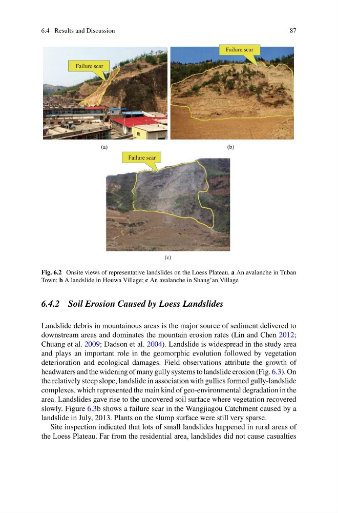
Fig. 6.2 Onsite views of representative landslides on the Loess Plateau. a An avalanche in Tuban
Town; b A landslide in Houwa Village; c An avalanche in Shang’an Village
6.4.2 Soil Erosion Caused by Loess Landslides
Landslide debris in mountainous areas is the major source of sediment delivered to
downstream areas and dominates the mountain erosion rates (Lin and Chen 2012;
Chuang et al. 2009; Dadson et al. 2004). Landslide is widespread in the study area
and plays an important role in the geomorphic evolution followed by vegetation
deterioration and ecological damages. Field observations attribute the growth of
headwaters and the widening of many gully systems to landslide erosion (Fig. 6.3). On
the relatively steep slope, landslide in association with gullies formed gully-landslide
complexes, which represented the main kind of geo-environmental degradation in the
area. Landslides gave rise to the uncovered soil surface where vegetation recovered
slowly. Figure 6.3b shows a failure scar in the Wangjiagou Catchment caused by a
landslide in July, 2013. Plants on the slump surface were still very sparse.
Site inspection indicated that lots of small landslides happened in rural areas of
the Loess Plateau. Far from the residential area, landslides did not cause casualties
87
Failure scar
Failure scar
(b)
(a)
Failure scar
(c)
Fig. 6.2 Onsite views of representative landslides on the Loess Plateau. a An avalanche in Tuban
Town; b A landslide in Houwa Village; c An avalanche in Shang’an Village
6.4.2 Soil Erosion Caused by Loess Landslides
Landslide debris in mountainous areas is the major source of sediment delivered to
downstream areas and dominates the mountain erosion rates (Lin and Chen 2012;
Chuang et al. 2009; Dadson et al. 2004). Landslide is widespread in the study area
and plays an important role in the geomorphic evolution followed by vegetation
deterioration and ecological damages. Field observations attribute the growth of
headwaters and the widening of many gully systems to landslide erosion (Fig. 6.3). On
the relatively steep slope, landslide in association with gullies formed gully-landslide
complexes, which represented the main kind of geo-environmental degradation in the
area. Landslides gave rise to the uncovered soil surface where vegetation recovered
slowly. Figure 6.3b shows a failure scar in the Wangjiagou Catchment caused by a
landslide in July, 2013. Plants on the slump surface were still very sparse.
Site inspection indicated that lots of small landslides happened in rural areas of
the Loess Plateau. Far from the residential area, landslides did not cause casualties