

163
dominated deltaic complex of approximately 426,300 ha formed by the depositional
activities of the Ganges and the Brahmaputra. A group of islands and a dense network of rivers, canals and creeks comprise the area. It has been suggested that, in
the past, the tidal swamps of the Sundarbans extended landward to the base of the
Rajmahal hills and filled up in the later part of the Tertiary period (Fergusson 1863).
A number of geomorphological and resultant hydrological changes have contributed to the present location and condition of the Sundarbans. Tectonic movements
in the late Tertiary period in northwestern Punjab changed the course of the IndoBrahma River. Some workers consider this phenomenon as the cause behind the
beginning of the southeastern flow of the River Ganges (Wadia 1961). Geologists
believe that there was a general southeastern slope of the Bengal Basin during the
Tertiary period. The Ganges started flowing down this slope and created a new delta
through thousand years of time by silt deposition. Gradually the western part of
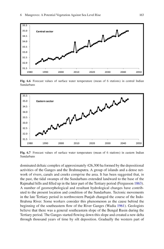
Fig. 6.6 Forecast values of surface water temperature (mean of 6 stations) in central Indian
Sundarbans
Fig. 6.7 Forecast values of surface water temperature (mean of 6 stations) in eastern Indian
Sundarbans
6 Mangroves: A Potential Vegetation Against Sea Level Rise
dominated deltaic complex of approximately 426,300 ha formed by the depositional
activities of the Ganges and the Brahmaputra. A group of islands and a dense network of rivers, canals and creeks comprise the area. It has been suggested that, in
the past, the tidal swamps of the Sundarbans extended landward to the base of the
Rajmahal hills and filled up in the later part of the Tertiary period (Fergusson 1863).
A number of geomorphological and resultant hydrological changes have contributed to the present location and condition of the Sundarbans. Tectonic movements
in the late Tertiary period in northwestern Punjab changed the course of the IndoBrahma River. Some workers consider this phenomenon as the cause behind the
beginning of the southeastern flow of the River Ganges (Wadia 1961). Geologists
believe that there was a general southeastern slope of the Bengal Basin during the
Tertiary period. The Ganges started flowing down this slope and created a new delta
through thousand years of time by silt deposition. Gradually the western part of
Fig. 6.6 Forecast values of surface water temperature (mean of 6 stations) in central Indian
Sundarbans
Fig. 6.7 Forecast values of surface water temperature (mean of 6 stations) in eastern Indian
Sundarbans
6 Mangroves: A Potential Vegetation Against Sea Level Rise