

Vol:.(1234567890)
Research Article
SN Applied Sciences
(2023) 5:158
| https://doi.org/10.1007/s42452-023-05376-x
and decision-makers to holistically identify areas vulnerable to oil spills.
Figure 3 indicates the physical sensitivity based on
the characteristics of the shoreline, soft sandy substrate
or rocky substrate, beaches, and seabed that contribute
to biological activity and are resistant to impacts associated with oil spills. The study area was divided into 4
zones according to the degree of physical sensitivity.
The classification of the analyzed sites depends strongly
on the degree of anthropic occupation, as observed by
Rangel-Buitrago et al. [51].
Figure 4. shows that socio-economic sensitivity is
based on the human use of resources that contribute
to the economy of the area tourism, port, and factories).
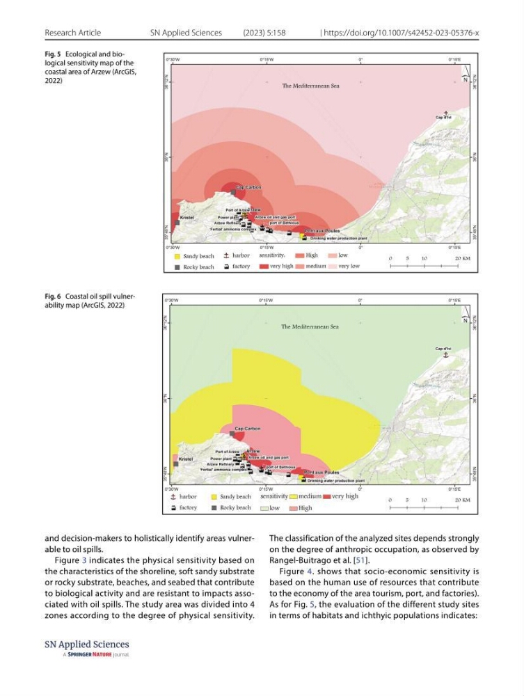
As for Fig. 5, the evaluation of the different study sites
in terms of habitats and ichthyic populations indicates:
Fig. 5 Ecological and biological sensitivity map of the
coastal area of Arzew (ArcGIS,
2022)
Fig. 6 Coastal oil spill vulnerability map (ArcGIS, 2022)
Research Article
SN Applied Sciences
(2023) 5:158
| https://doi.org/10.1007/s42452-023-05376-x
and decision-makers to holistically identify areas vulnerable to oil spills.
Figure 3 indicates the physical sensitivity based on
the characteristics of the shoreline, soft sandy substrate
or rocky substrate, beaches, and seabed that contribute
to biological activity and are resistant to impacts associated with oil spills. The study area was divided into 4
zones according to the degree of physical sensitivity.
The classification of the analyzed sites depends strongly
on the degree of anthropic occupation, as observed by
Rangel-Buitrago et al. [51].
Figure 4. shows that socio-economic sensitivity is
based on the human use of resources that contribute
to the economy of the area tourism, port, and factories).
As for Fig. 5, the evaluation of the different study sites
in terms of habitats and ichthyic populations indicates:
Fig. 5 Ecological and biological sensitivity map of the
coastal area of Arzew (ArcGIS,
2022)
Fig. 6 Coastal oil spill vulnerability map (ArcGIS, 2022)