

Chapter I
Climatological data for the study area
5
I.4. Climatological data for the study area
This section focuses on the analysis of wave and wind climate in the study area. It provides an
overview of the extracted wave data, including significant wave height and period, as well as
wave direction distribution. Additionally, it presents the recorded wind speed data and analyzes
wind direction patterns throughout thirty years.
I.4.1. Wave climate
Wave climate is defined as the distribution of wave height, period, and direction in which they
occur. It is determined by averaging these wave properties over a specific time period and
location.
The 30-year wave climate data used in the presented study is extracted from infoplaza. We have
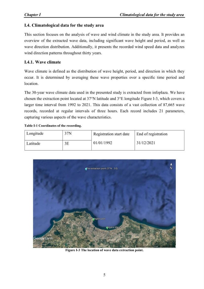
chosen the extraction point located at 37°N latitude and 3°E longitude Figure I-3, which covers a
larger time interval from 1992 to 2021. This data consists of a vast collection of 87,665 wave
records, recorded at regular intervals of three hours. Each record includes 21 parameters,
capturing various aspects of the wave characteristics.
Table I-1 Coordinates of the recording.
Longitude
37N
Registration start date
01/01/1992
End of registration
31/12/2021
Latitude
3E
Figure I-3 The location of wave data extraction point.
Climatological data for the study area
5
I.4. Climatological data for the study area
This section focuses on the analysis of wave and wind climate in the study area. It provides an
overview of the extracted wave data, including significant wave height and period, as well as
wave direction distribution. Additionally, it presents the recorded wind speed data and analyzes
wind direction patterns throughout thirty years.
I.4.1. Wave climate
Wave climate is defined as the distribution of wave height, period, and direction in which they
occur. It is determined by averaging these wave properties over a specific time period and
location.
The 30-year wave climate data used in the presented study is extracted from infoplaza. We have
chosen the extraction point located at 37°N latitude and 3°E longitude Figure I-3, which covers a
larger time interval from 1992 to 2021. This data consists of a vast collection of 87,665 wave
records, recorded at regular intervals of three hours. Each record includes 21 parameters,
capturing various aspects of the wave characteristics.
Table I-1 Coordinates of the recording.
Longitude
37N
Registration start date
01/01/1992
End of registration
31/12/2021
Latitude
3E
Figure I-3 The location of wave data extraction point.