

Chapter I
Climatological data for the study area
4
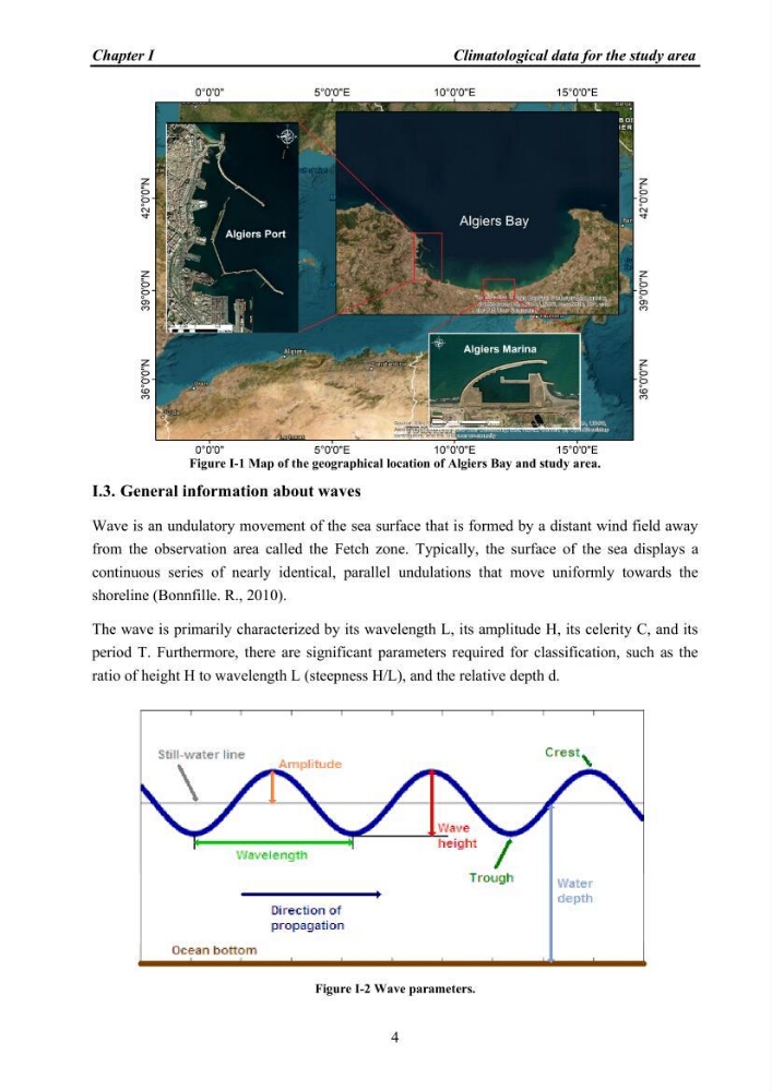
Figure I-1 Map of the geographical location of Algiers Bay and study area.
I.3. General information about waves
Wave is an undulatory movement of the sea surface that is formed by a distant wind field away
from the observation area called the Fetch zone. Typically, the surface of the sea displays a
continuous series of nearly identical, parallel undulations that move uniformly towards the
shoreline (Bonnfille. R., 2010).
The wave is primarily characterized by its wavelength L, its amplitude H, its celerity C, and its
period T. Furthermore, there are significant parameters required for classification, such as the
ratio of height H to wavelength L (steepness H/L), and the relative depth d.
Figure I-2 Wave parameters.
Climatological data for the study area
4
Figure I-1 Map of the geographical location of Algiers Bay and study area.
I.3. General information about waves
Wave is an undulatory movement of the sea surface that is formed by a distant wind field away
from the observation area called the Fetch zone. Typically, the surface of the sea displays a
continuous series of nearly identical, parallel undulations that move uniformly towards the
shoreline (Bonnfille. R., 2010).
The wave is primarily characterized by its wavelength L, its amplitude H, its celerity C, and its
period T. Furthermore, there are significant parameters required for classification, such as the
ratio of height H to wavelength L (steepness H/L), and the relative depth d.
Figure I-2 Wave parameters.