

440
M. Goswami and S. Nautiyal
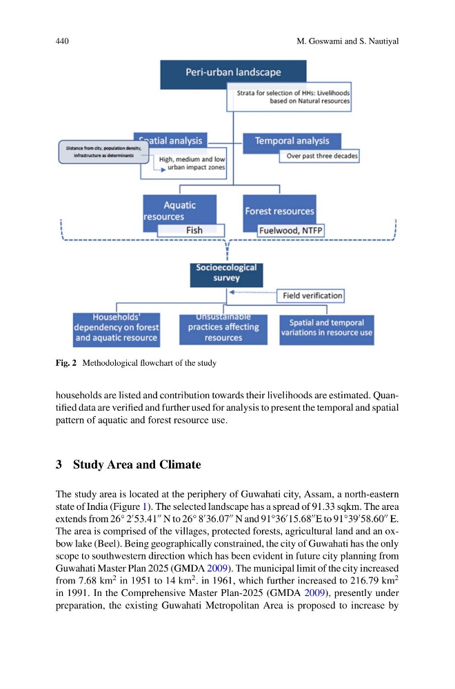
Fig. 2 Methodological flowchart of the study
households are listed and contribution towards their livelihoods are estimated. Quantified data are verified and further used for analysis to present the temporal and spatial
pattern of aquatic and forest resource use.
3 Study Area and Climate
The study area is located at the periphery of Guwahati city, Assam, a north-eastern
state of India (Figure 1). The selected landscape has a spread of 91.33 sqkm. The area
extends from 26° 2
53.41
N to 26° 8
36.07
N and 91°36
15.68
E to 91°39
58.60
E.
The area is comprised of the villages, protected forests, agricultural land and an oxbow lake (Beel). Being geographically constrained, the city of Guwahati has the only
scope to southwestern direction which has been evident in future city planning from
Guwahati Master Plan 2025 (GMDA 2009). The municipal limit of the city increased
from 7.68 km
2 in 1951 to 14 km
2 . in 1961, which further increased to 216.79 km
2
in 1991. In the Comprehensive Master Plan-2025 (GMDA 2009), presently under
preparation, the existing Guwahati Metropolitan Area is proposed to increase by
M. Goswami and S. Nautiyal
Fig. 2 Methodological flowchart of the study
households are listed and contribution towards their livelihoods are estimated. Quantified data are verified and further used for analysis to present the temporal and spatial
pattern of aquatic and forest resource use.
3 Study Area and Climate
The study area is located at the periphery of Guwahati city, Assam, a north-eastern
state of India (Figure 1). The selected landscape has a spread of 91.33 sqkm. The area
extends from 26° 2
53.41
N to 26° 8
36.07
N and 91°36
15.68
E to 91°39
58.60
E.
The area is comprised of the villages, protected forests, agricultural land and an oxbow lake (Beel). Being geographically constrained, the city of Guwahati has the only
scope to southwestern direction which has been evident in future city planning from
Guwahati Master Plan 2025 (GMDA 2009). The municipal limit of the city increased
from 7.68 km
2 in 1951 to 14 km
2 . in 1961, which further increased to 216.79 km
2
in 1991. In the Comprehensive Master Plan-2025 (GMDA 2009), presently under
preparation, the existing Guwahati Metropolitan Area is proposed to increase by