

564
R. B˘ atina¸ s et al.
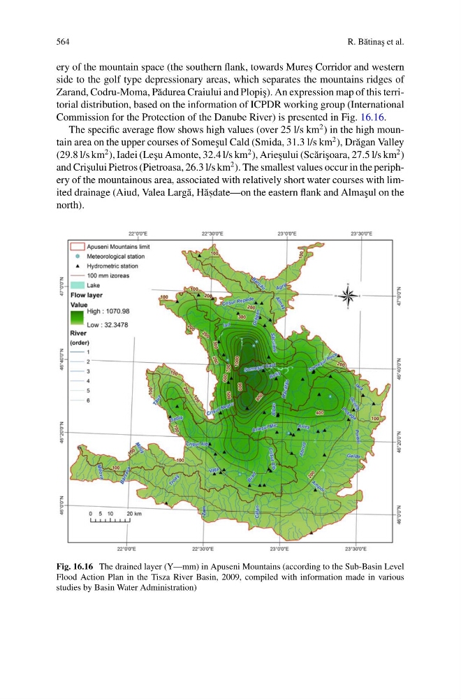
ery of the mountain space (the southern flank, towards Mures , Corridor and western
side to the golf type depressionary areas, which separates the mountains ridges of
Zarand, Codru-Moma, P˘ adurea Craiului and Plopi¸ s). An expression map of this territorial distribution, based on the information of ICPDR working group (International
Commission for the Protection of the Danube River) is presented in Fig. 16.16.
The specific average flow shows high values (over 25 l/s km
2 ) in the high mountain area on the upper courses of Some¸ sul Cald (Smida, 31.3 l/s km
2 ), Dr˘ agan Valley
(29.8 l/s km
2 ), Iadei (Le¸ su Amonte, 32.4 l/s km
2 ), Arie¸ sului (Sc˘ ari¸ soara, 27.5 l/s km
2 )
and Cri¸ sului Pietros (Pietroasa, 26.3 l/s km
2 ). The smallest values occur in the periphery of the mountainous area, associated with relatively short water courses with limited drainage (Aiud, Valea Larg˘ a, H˘ as , date—on the eastern flank and Alma¸ sul on the
north).
Fig. 16.16 The drained layer (Y—mm) in Apuseni Mountains (according to the Sub-Basin Level
Flood Action Plan in the Tisza River Basin, 2009, compiled with information made in various
studies by Basin Water Administration)
R. B˘ atina¸ s et al.
ery of the mountain space (the southern flank, towards Mures , Corridor and western
side to the golf type depressionary areas, which separates the mountains ridges of
Zarand, Codru-Moma, P˘ adurea Craiului and Plopi¸ s). An expression map of this territorial distribution, based on the information of ICPDR working group (International
Commission for the Protection of the Danube River) is presented in Fig. 16.16.
The specific average flow shows high values (over 25 l/s km
2 ) in the high mountain area on the upper courses of Some¸ sul Cald (Smida, 31.3 l/s km
2 ), Dr˘ agan Valley
(29.8 l/s km
2 ), Iadei (Le¸ su Amonte, 32.4 l/s km
2 ), Arie¸ sului (Sc˘ ari¸ soara, 27.5 l/s km
2 )
and Cri¸ sului Pietros (Pietroasa, 26.3 l/s km
2 ). The smallest values occur in the periphery of the mountainous area, associated with relatively short water courses with limited drainage (Aiud, Valea Larg˘ a, H˘ as , date—on the eastern flank and Alma¸ sul on the
north).
Fig. 16.16 The drained layer (Y—mm) in Apuseni Mountains (according to the Sub-Basin Level
Flood Action Plan in the Tisza River Basin, 2009, compiled with information made in various
studies by Basin Water Administration)