

16 Water Resources from Apuseni Mountains …
543
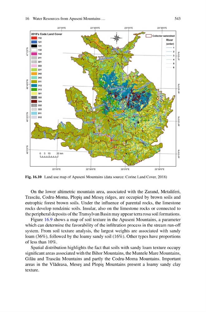
Fig. 16.10 Land use map of Apuseni Mountains (data source: Corine Land Cover, 2018)
On the lower altimetric mountain area, associated with the Zarand, Metaliferi,
Trasc˘ au, Codru-Moma, Plopi¸ s and Mese¸ s ridges, are occupied by brown soils and
eutrophic forest brown soils. Under the influence of parental rocks, the limestone
rocks develop rendzinic soils. Insular, also on the limestone rocks or connected to
the peripheral deposits of the Transylvan Basin may appear terra rosa soil formations.
Figure 16.9 shows a map of soil texture in the Apuseni Mountains, a parameter
which can determine the favorability of the infiltration process in the stream run-off
system. From soil texture analysis, the largest weights are associated with sandy
loam (36%), followed by the loamy sandy soil (16%). Other types have proportions
of less than 10%.
Spatial distribution highlights the fact that soils with sandy loam texture occupy
significant areas associated with the Bihor Mountains, the Muntele Mare Mountains,
Gil˘ au and Trasc˘ au Mountains and partly the Codru-Moma Mountains. Important
areas in the Vl˘ adeasa, Mese¸ s and Plopi¸ s Mountains present a loamy sandy clay
texture.
543
Fig. 16.10 Land use map of Apuseni Mountains (data source: Corine Land Cover, 2018)
On the lower altimetric mountain area, associated with the Zarand, Metaliferi,
Trasc˘ au, Codru-Moma, Plopi¸ s and Mese¸ s ridges, are occupied by brown soils and
eutrophic forest brown soils. Under the influence of parental rocks, the limestone
rocks develop rendzinic soils. Insular, also on the limestone rocks or connected to
the peripheral deposits of the Transylvan Basin may appear terra rosa soil formations.
Figure 16.9 shows a map of soil texture in the Apuseni Mountains, a parameter
which can determine the favorability of the infiltration process in the stream run-off
system. From soil texture analysis, the largest weights are associated with sandy
loam (36%), followed by the loamy sandy soil (16%). Other types have proportions
of less than 10%.
Spatial distribution highlights the fact that soils with sandy loam texture occupy
significant areas associated with the Bihor Mountains, the Muntele Mare Mountains,
Gil˘ au and Trasc˘ au Mountains and partly the Codru-Moma Mountains. Important
areas in the Vl˘ adeasa, Mese¸ s and Plopi¸ s Mountains present a loamy sandy clay
texture.