

532
R. B˘ atina¸ s et al.
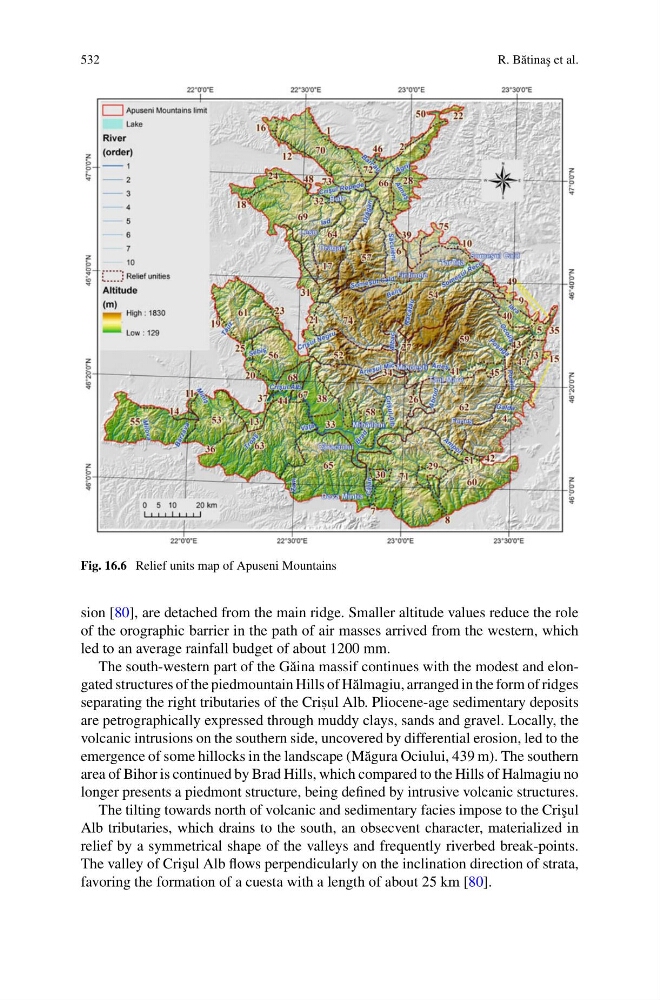
Fig. 16.6 Relief units map of Apuseni Mountains
sion [80], are detached from the main ridge. Smaller altitude values reduce the role
of the orographic barrier in the path of air masses arrived from the western, which
led to an average rainfall budget of about 1200 mm.
The south-western part of the G˘ aina massif continues with the modest and elongated structures of the piedmountain Hills of H˘ almagiu, arranged in the form of ridges
separating the right tributaries of the Cris , ul Alb. Pliocene-age sedimentary deposits
are petrographically expressed through muddy clays, sands and gravel. Locally, the
volcanic intrusions on the southern side, uncovered by differential erosion, led to the
emergence of some hillocks in the landscape (M˘ agura Ociului, 439 m). The southern
area of Bihor is continued by Brad Hills, which compared to the Hills of Halmagiu no
longer presents a piedmont structure, being defined by intrusive volcanic structures.
The tilting towards north of volcanic and sedimentary facies impose to the Cri¸ sul
Alb tributaries, which drains to the south, an obsecvent character, materialized in
relief by a symmetrical shape of the valleys and frequently riverbed break-points.
The valley of Cri¸ sul Alb flows perpendicularly on the inclination direction of strata,
favoring the formation of a cuesta with a length of about 25 km [80].
R. B˘ atina¸ s et al.
Fig. 16.6 Relief units map of Apuseni Mountains
sion [80], are detached from the main ridge. Smaller altitude values reduce the role
of the orographic barrier in the path of air masses arrived from the western, which
led to an average rainfall budget of about 1200 mm.
The south-western part of the G˘ aina massif continues with the modest and elongated structures of the piedmountain Hills of H˘ almagiu, arranged in the form of ridges
separating the right tributaries of the Cris , ul Alb. Pliocene-age sedimentary deposits
are petrographically expressed through muddy clays, sands and gravel. Locally, the
volcanic intrusions on the southern side, uncovered by differential erosion, led to the
emergence of some hillocks in the landscape (M˘ agura Ociului, 439 m). The southern
area of Bihor is continued by Brad Hills, which compared to the Hills of Halmagiu no
longer presents a piedmont structure, being defined by intrusive volcanic structures.
The tilting towards north of volcanic and sedimentary facies impose to the Cri¸ sul
Alb tributaries, which drains to the south, an obsecvent character, materialized in
relief by a symmetrical shape of the valleys and frequently riverbed break-points.
The valley of Cri¸ sul Alb flows perpendicularly on the inclination direction of strata,
favoring the formation of a cuesta with a length of about 25 km [80].