

522
R. B˘ atina¸ s et al.
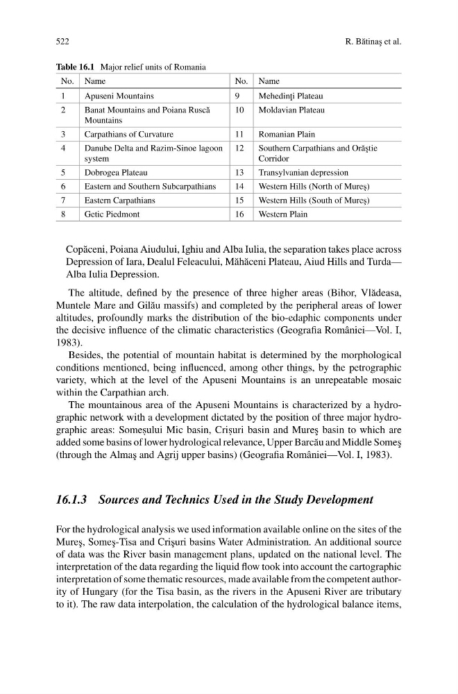
Table 16.1 Major relief units of Romania
No. Name
No. Name
1
Apuseni Mountains
9
Mehedin¸ ti Plateau
2
Banat Mountains and Poiana Rusc˘ a
Mountains
10
Moldavian Plateau
3
Carpathians of Curvature
11
Romanian Plain
4
Danube Delta and Razim-Sinoe lagoon
system
12
Southern Carpathians and Or˘ a¸ stie
Corridor
5
Dobrogea Plateau
13
Transylvanian depression
6
Eastern and Southern Subcarpathians
14
Western Hills (North of Mure¸ s)
7
Eastern Carpathians
15
Western Hills (South of Mure¸ s)
8
Getic Piedmont
16
Western Plain
Cop˘ aceni, Poiana Aiudului, Ighiu and Alba Iulia, the separation takes place across
Depression of Iara, Dealul Feleacului, M˘ ah˘ aceni Plateau, Aiud Hills and Turda—
Alba Iulia Depression.
The altitude, defined by the presence of three higher areas (Bihor, Vl˘ adeasa,
Muntele Mare and Gil˘ au massifs) and completed by the peripheral areas of lower
altitudes, profoundly marks the distribution of the bio-edaphic components under
the decisive influence of the climatic characteristics (Geografia României—Vol. I,
1983).
Besides, the potential of mountain habitat is determined by the morphological
conditions mentioned, being influenced, among other things, by the petrographic
variety, which at the level of the Apuseni Mountains is an unrepeatable mosaic
within the Carpathian arch.
The mountainous area of the Apuseni Mountains is characterized by a hydrographic network with a development dictated by the position of three major hydrographic areas: Somes , ului Mic basin, Cris , uri basin and Mure¸ s basin to which are
added some basins of lower hydrological relevance, Upper Barc˘ au and Middle Some¸ s
(through the Alma¸ s and Agrij upper basins) (Geografia României—Vol. I, 1983).
16.1.3 Sources and Technics Used in the Study Development
For the hydrological analysis we used information available online on the sites of the
Mure¸ s, Some¸ s-Tisa and Cri¸ suri basins Water Administration. An additional source
of data was the River basin management plans, updated on the national level. The
interpretation of the data regarding the liquid flow took into account the cartographic
interpretation of some thematic resources, made available from the competent authority of Hungary (for the Tisa basin, as the rivers in the Apuseni River are tributary
to it). The raw data interpolation, the calculation of the hydrological balance items,
R. B˘ atina¸ s et al.
Table 16.1 Major relief units of Romania
No. Name
No. Name
1
Apuseni Mountains
9
Mehedin¸ ti Plateau
2
Banat Mountains and Poiana Rusc˘ a
Mountains
10
Moldavian Plateau
3
Carpathians of Curvature
11
Romanian Plain
4
Danube Delta and Razim-Sinoe lagoon
system
12
Southern Carpathians and Or˘ a¸ stie
Corridor
5
Dobrogea Plateau
13
Transylvanian depression
6
Eastern and Southern Subcarpathians
14
Western Hills (North of Mure¸ s)
7
Eastern Carpathians
15
Western Hills (South of Mure¸ s)
8
Getic Piedmont
16
Western Plain
Cop˘ aceni, Poiana Aiudului, Ighiu and Alba Iulia, the separation takes place across
Depression of Iara, Dealul Feleacului, M˘ ah˘ aceni Plateau, Aiud Hills and Turda—
Alba Iulia Depression.
The altitude, defined by the presence of three higher areas (Bihor, Vl˘ adeasa,
Muntele Mare and Gil˘ au massifs) and completed by the peripheral areas of lower
altitudes, profoundly marks the distribution of the bio-edaphic components under
the decisive influence of the climatic characteristics (Geografia României—Vol. I,
1983).
Besides, the potential of mountain habitat is determined by the morphological
conditions mentioned, being influenced, among other things, by the petrographic
variety, which at the level of the Apuseni Mountains is an unrepeatable mosaic
within the Carpathian arch.
The mountainous area of the Apuseni Mountains is characterized by a hydrographic network with a development dictated by the position of three major hydrographic areas: Somes , ului Mic basin, Cris , uri basin and Mure¸ s basin to which are
added some basins of lower hydrological relevance, Upper Barc˘ au and Middle Some¸ s
(through the Alma¸ s and Agrij upper basins) (Geografia României—Vol. I, 1983).
16.1.3 Sources and Technics Used in the Study Development
For the hydrological analysis we used information available online on the sites of the
Mure¸ s, Some¸ s-Tisa and Cri¸ suri basins Water Administration. An additional source
of data was the River basin management plans, updated on the national level. The
interpretation of the data regarding the liquid flow took into account the cartographic
interpretation of some thematic resources, made available from the competent authority of Hungary (for the Tisa basin, as the rivers in the Apuseni River are tributary
to it). The raw data interpolation, the calculation of the hydrological balance items,