

402
G. ¸
Serban et al.
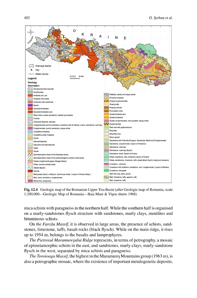
Fig. 12.4 Geologic map of the Romanian Upper Tisa Basin (after Geologic map of Romania, scale
1:200,000—Geologic Map of Romania—Baia Mare & Vi¸ seu sheets 1968)
mica schists with paragneiss in the northern half. While the southern half is organised
on a marly-sandstones flysch structure with sandstones, marly clays, menilites and
bituminous schists.
On the Farc˘ au Massif, it is observed in large areas, the presence of schists, sandstones, limestone, tuffs, basalt rocks (black flysch). While on the main ridge, it rises
up to 1954 m, belongs to the basalts and lamprophyres.
The Pietrosul Maramure¸ sului Ridge represents, in terms of petrography, a mosaic
of epimetamorphic schists in the east, and sandstones, marly-clays, marly-sandstone
flysch in the west, separated by mica schists and paragneiss.
The Toroioaga Massif, the highest in the Maramure¸ s Mountains group (1963 m), is
also a petrographic mosaic, where the existence of important metalogenetic deposits,
G. ¸
Serban et al.
Fig. 12.4 Geologic map of the Romanian Upper Tisa Basin (after Geologic map of Romania, scale
1:200,000—Geologic Map of Romania—Baia Mare & Vi¸ seu sheets 1968)
mica schists with paragneiss in the northern half. While the southern half is organised
on a marly-sandstones flysch structure with sandstones, marly clays, menilites and
bituminous schists.
On the Farc˘ au Massif, it is observed in large areas, the presence of schists, sandstones, limestone, tuffs, basalt rocks (black flysch). While on the main ridge, it rises
up to 1954 m, belongs to the basalts and lamprophyres.
The Pietrosul Maramure¸ sului Ridge represents, in terms of petrography, a mosaic
of epimetamorphic schists in the east, and sandstones, marly-clays, marly-sandstone
flysch in the west, separated by mica schists and paragneiss.
The Toroioaga Massif, the highest in the Maramure¸ s Mountains group (1963 m), is
also a petrographic mosaic, where the existence of important metalogenetic deposits,