

258
C. Trifanov et al.
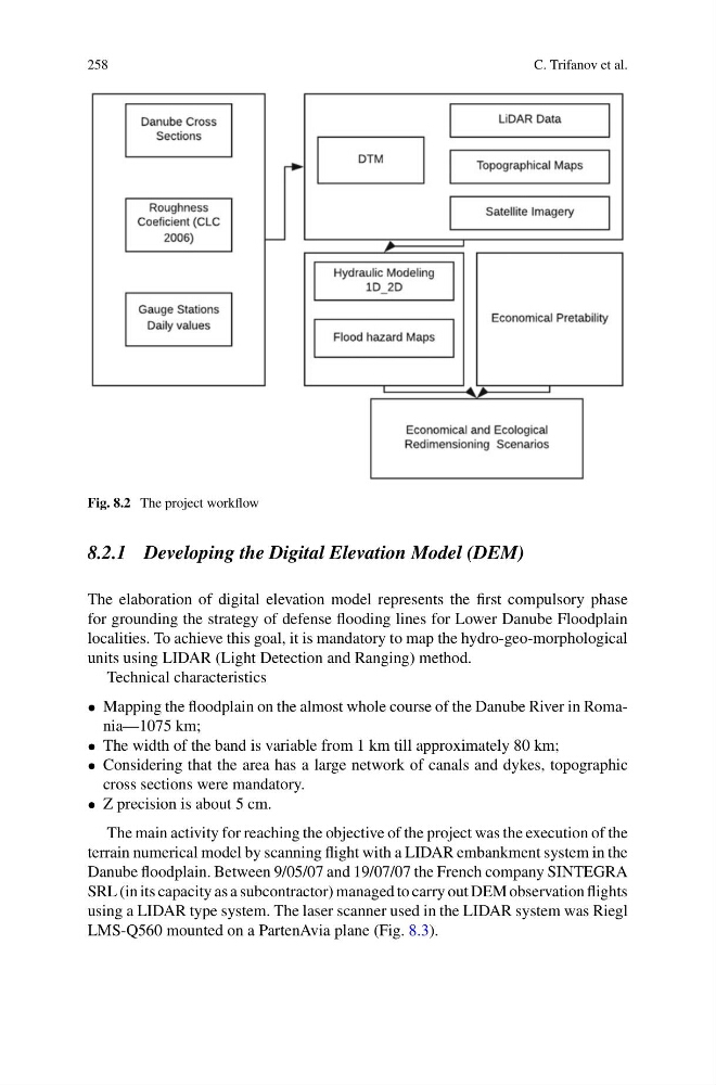
Fig. 8.2 The project workflow
8.2.1 Developing the Digital Elevation Model (DEM)
The elaboration of digital elevation model represents the first compulsory phase
for grounding the strategy of defense flooding lines for Lower Danube Floodplain
localities. To achieve this goal, it is mandatory to map the hydro-geo-morphological
units using LIDAR (Light Detection and Ranging) method.
Technical characteristics
• Mapping the floodplain on the almost whole course of the Danube River in Romania—1075 km;
• The width of the band is variable from 1 km till approximately 80 km;
• Considering that the area has a large network of canals and dykes, topographic
cross sections were mandatory.
• Z precision is about 5 cm.
The main activity for reaching the objective of the project was the execution of the
terrain numerical model by scanning flight with a LIDAR embankment system in the
Danube floodplain. Between 9/05/07 and 19/07/07 the French company SINTEGRA
SRL (in its capacity as a subcontractor) managed to carry out DEM observation flights
using a LIDAR type system. The laser scanner used in the LIDAR system was Riegl
LMS-Q560 mounted on a PartenAvia plane (Fig. 8.3).
C. Trifanov et al.
Fig. 8.2 The project workflow
8.2.1 Developing the Digital Elevation Model (DEM)
The elaboration of digital elevation model represents the first compulsory phase
for grounding the strategy of defense flooding lines for Lower Danube Floodplain
localities. To achieve this goal, it is mandatory to map the hydro-geo-morphological
units using LIDAR (Light Detection and Ranging) method.
Technical characteristics
• Mapping the floodplain on the almost whole course of the Danube River in Romania—1075 km;
• The width of the band is variable from 1 km till approximately 80 km;
• Considering that the area has a large network of canals and dykes, topographic
cross sections were mandatory.
• Z precision is about 5 cm.
The main activity for reaching the objective of the project was the execution of the
terrain numerical model by scanning flight with a LIDAR embankment system in the
Danube floodplain. Between 9/05/07 and 19/07/07 the French company SINTEGRA
SRL (in its capacity as a subcontractor) managed to carry out DEM observation flights
using a LIDAR type system. The laser scanner used in the LIDAR system was Riegl
LMS-Q560 mounted on a PartenAvia plane (Fig. 8.3).