

135
(6) Transverse Ranges, (7) mountains and hills of Aldama and Rio Grande, (8)
mountains and plains of the North (Fig. 8.2).
Precipitation Data
The CFSR is the product of a global climate reanalysis and is provided as gridded
data generated by the NCEP Global Forecast System (Saha et al. 2010). The CFSR
weather data are a product based on habitual ground observation data, satellite
remote sensing data, and other advanced technology and represent a global,
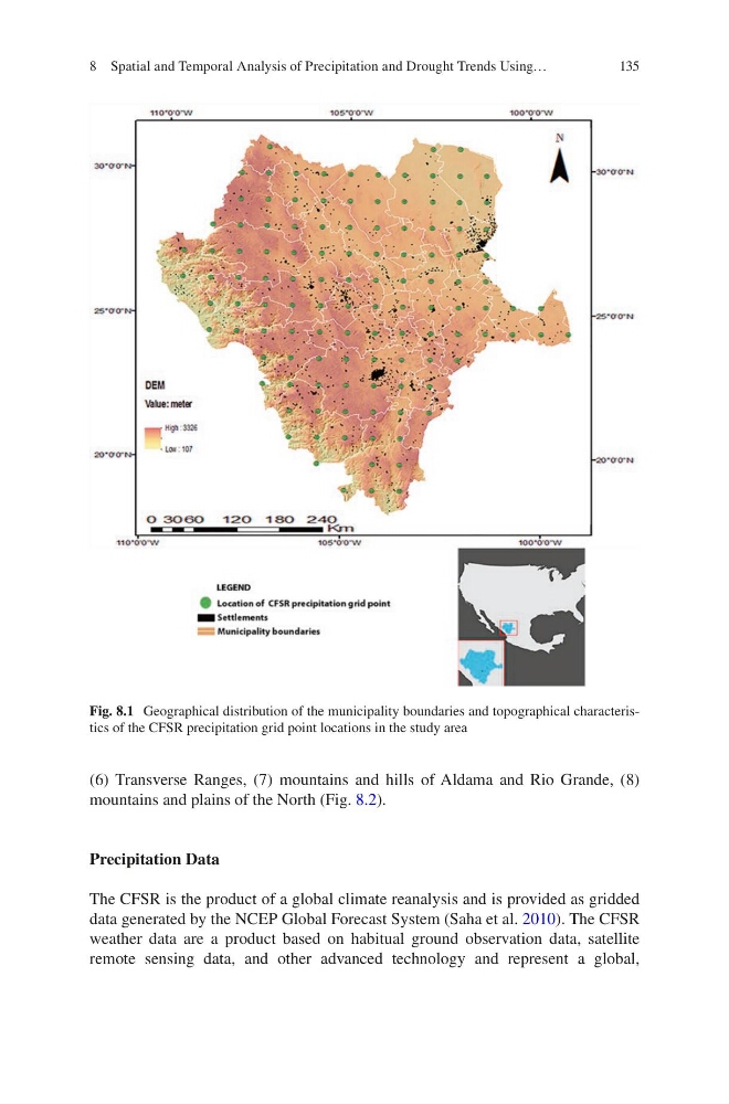
Fig. 8.1 Geographical distribution of the municipality boundaries and topographical characteristics of the CFSR precipitation grid point locations in the study area
8 Spatial and Temporal Analysis of Precipitation and Drought Trends Using…
(6) Transverse Ranges, (7) mountains and hills of Aldama and Rio Grande, (8)
mountains and plains of the North (Fig. 8.2).
Precipitation Data
The CFSR is the product of a global climate reanalysis and is provided as gridded
data generated by the NCEP Global Forecast System (Saha et al. 2010). The CFSR
weather data are a product based on habitual ground observation data, satellite
remote sensing data, and other advanced technology and represent a global,
Fig. 8.1 Geographical distribution of the municipality boundaries and topographical characteristics of the CFSR precipitation grid point locations in the study area
8 Spatial and Temporal Analysis of Precipitation and Drought Trends Using…