

136
high- resolution coupled atmosphere–sea ice–ocean–land system. The CFSR global
atmosphere data have a spatial resolution of approximately 38 km, and the data are
available since 1979. The CFSR weather data for the study area (bounding box: latitude: 27.21°–22.16°N and longitude: 102.18°–107.63°W) were downloaded from
the SWAT model’s official website (http://globaweather.tamu.edu/). The data
includes daily rainfall, maximum and minimum temperature, as well as wind speed,
and solar radiation for 117 locations (Fig. 8.1).
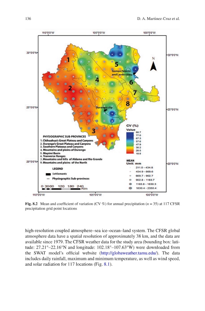
Fig. 8.2 Mean and coefficient of variation (CV %) for annual precipitation (n = 35) at 117 CFSR
precipitation grid point locations
D. A. Martinez-Cruz et al.
high- resolution coupled atmosphere–sea ice–ocean–land system. The CFSR global
atmosphere data have a spatial resolution of approximately 38 km, and the data are
available since 1979. The CFSR weather data for the study area (bounding box: latitude: 27.21°–22.16°N and longitude: 102.18°–107.63°W) were downloaded from
the SWAT model’s official website (http://globaweather.tamu.edu/). The data
includes daily rainfall, maximum and minimum temperature, as well as wind speed,
and solar radiation for 117 locations (Fig. 8.1).
Fig. 8.2 Mean and coefficient of variation (CV %) for annual precipitation (n = 35) at 117 CFSR
precipitation grid point locations
D. A. Martinez-Cruz et al.