

449
80% of global crop production and have a substantially strong impact on international food markets. GEOGLAM aims to improve agricultural monitoring at
national, regional, and global scales using state-of-the-art remote sensing technologies. Ultimately, the goal is improving food production and food security.
Data collection: GEOGLAM starts with global data collection using integrated
satellite imageries and ground-based measurements. Earth observations from a variety of facilitates are coordinated and preprocessed to prepare reliable data sources
for global crop monitoring.
Crop monitoring: The initiative monitors primarily four crops, namely, corn,
wheat, rice, and soybeans. GEOGLAM offers capacity for crop classification (e.g.,
growing conditions, status), crop yield prediction as well as an early warning for
countries at risk for food insecurity. The monitoring tasks are not executed using a
single model but based on a set of existing models and tools developed nationally or
internationally. Existing models developed at a local region may contain methods
and parameters tuned to local climates, weather conditions, etc. which make them
unsuitable for a different geographic region. Thus, for more accurate results, the
models are implemented at different scales to account for spatial heterogeneity and
integrated together to enable monitoring at a global scale.
Interactive tools: GEOGLAM provides tools with interactive interfaces for
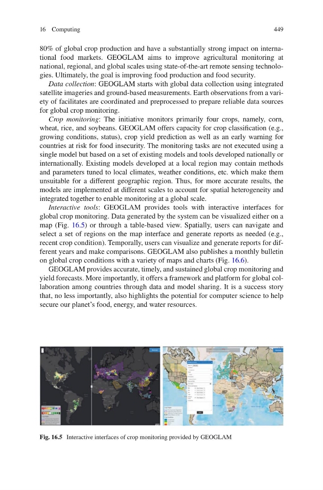
global crop monitoring. Data generated by the system can be visualized either on a
map (Fig. 16.5) or through a table-based view. Spatially, users can navigate and
select a set of regions on the map interface and generate reports as needed (e.g.,
recent crop condition). Temporally, users can visualize and generate reports for different years and make comparisons. GEOGLAM also publishes a monthly bulletin
on global crop conditions with a variety of maps and charts (Fig. 16.6).
GEOGLAM provides accurate, timely, and sustained global crop monitoring and
yield forecasts. More importantly, it offers a framework and platform for global collaboration among countries through data and model sharing. It is a success story
that, no less importantly, also highlights the potential for computer science to help
secure our planet’s food, energy, and water resources.
Fig. 16.5 Interactive interfaces of crop monitoring provided by GEOGLAM
16 Computing
80% of global crop production and have a substantially strong impact on international food markets. GEOGLAM aims to improve agricultural monitoring at
national, regional, and global scales using state-of-the-art remote sensing technologies. Ultimately, the goal is improving food production and food security.
Data collection: GEOGLAM starts with global data collection using integrated
satellite imageries and ground-based measurements. Earth observations from a variety of facilitates are coordinated and preprocessed to prepare reliable data sources
for global crop monitoring.
Crop monitoring: The initiative monitors primarily four crops, namely, corn,
wheat, rice, and soybeans. GEOGLAM offers capacity for crop classification (e.g.,
growing conditions, status), crop yield prediction as well as an early warning for
countries at risk for food insecurity. The monitoring tasks are not executed using a
single model but based on a set of existing models and tools developed nationally or
internationally. Existing models developed at a local region may contain methods
and parameters tuned to local climates, weather conditions, etc. which make them
unsuitable for a different geographic region. Thus, for more accurate results, the
models are implemented at different scales to account for spatial heterogeneity and
integrated together to enable monitoring at a global scale.
Interactive tools: GEOGLAM provides tools with interactive interfaces for
global crop monitoring. Data generated by the system can be visualized either on a
map (Fig. 16.5) or through a table-based view. Spatially, users can navigate and
select a set of regions on the map interface and generate reports as needed (e.g.,
recent crop condition). Temporally, users can visualize and generate reports for different years and make comparisons. GEOGLAM also publishes a monthly bulletin
on global crop conditions with a variety of maps and charts (Fig. 16.6).
GEOGLAM provides accurate, timely, and sustained global crop monitoring and
yield forecasts. More importantly, it offers a framework and platform for global collaboration among countries through data and model sharing. It is a success story
that, no less importantly, also highlights the potential for computer science to help
secure our planet’s food, energy, and water resources.
Fig. 16.5 Interactive interfaces of crop monitoring provided by GEOGLAM
16 Computing