

90
4.3.3 Multispectral and Imaging Spectroscopy Data
Imaging spectroscopy data were acquired under clear sky conditions using the
APEX imaging spectrometer (Schaepman et al. 2015). The average flight altitude
was 4500 m a.s.l. resulting in an average ground pixel size of 2 m. APEX measured
at-sensor radiances in 316 spectral bands ranging from 372 nm to 2540 nm. APEX
data were processed to hemispherical-conical reflectance factors in the APEX processing and archiving facility (Hueni et al. 2009). Level 1 (L1) calibrated radiances
were obtained by inverting the instrument model, applying coefficients established
during calibration, and characterization at the APEX Calibration Home Base
(CHB) in Oberpfaffenhofen, Germany. The position and orientation of each pixel
in 3-D space was based on automatic geocoding in PARGE v3.269, using the swissALTI3D DTM. L1 data were then converted to hemispherical conical reflectance
factors (HCRFs, Schaepman-Strub et al. 2006) by employing ATCOR4 v7.0 in the
smile aware mode. The APEX data were complemented with other passive optical
data of varying spatial and spectral resolution to build up an EO data set (Fig. 4.5).
This EO data set enables cross-comparisons between the 3-D RT modeled and the
actual, measured top-of-atmosphere (TOA) reflectance values at different spectral
and spatial resolutions and thus an absolute evaluation of the 3-D reconstructed
forest scenes and the RTM parameterization. The EO data acquired during the
2010–2014 growing seasons covers a variety of spectral and spatial resolutions:
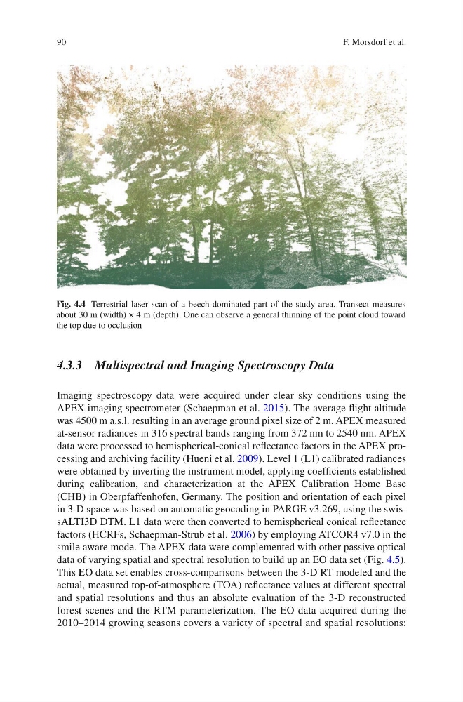
Fig. 4.4 Terrestrial laser scan of a beech-dominated part of the study area. Transect measures
about 30 m (width) × 4 m (depth). One can observe a general thinning of the point cloud toward
the top due to occlusion
F. Morsdorf et al.
4.3.3 Multispectral and Imaging Spectroscopy Data
Imaging spectroscopy data were acquired under clear sky conditions using the
APEX imaging spectrometer (Schaepman et al. 2015). The average flight altitude
was 4500 m a.s.l. resulting in an average ground pixel size of 2 m. APEX measured
at-sensor radiances in 316 spectral bands ranging from 372 nm to 2540 nm. APEX
data were processed to hemispherical-conical reflectance factors in the APEX processing and archiving facility (Hueni et al. 2009). Level 1 (L1) calibrated radiances
were obtained by inverting the instrument model, applying coefficients established
during calibration, and characterization at the APEX Calibration Home Base
(CHB) in Oberpfaffenhofen, Germany. The position and orientation of each pixel
in 3-D space was based on automatic geocoding in PARGE v3.269, using the swissALTI3D DTM. L1 data were then converted to hemispherical conical reflectance
factors (HCRFs, Schaepman-Strub et al. 2006) by employing ATCOR4 v7.0 in the
smile aware mode. The APEX data were complemented with other passive optical
data of varying spatial and spectral resolution to build up an EO data set (Fig. 4.5).
This EO data set enables cross-comparisons between the 3-D RT modeled and the
actual, measured top-of-atmosphere (TOA) reflectance values at different spectral
and spatial resolutions and thus an absolute evaluation of the 3-D reconstructed
forest scenes and the RTM parameterization. The EO data acquired during the
2010–2014 growing seasons covers a variety of spectral and spatial resolutions:
Fig. 4.4 Terrestrial laser scan of a beech-dominated part of the study area. Transect measures
about 30 m (width) × 4 m (depth). One can observe a general thinning of the point cloud toward
the top due to occlusion
F. Morsdorf et al.